Sunshine Coast Waterways and Coastal Management Strategy 2011-2021 - August 2014 edition
←
→
Page content transcription
If your browser does not render page correctly, please read the page content below
Sunshine Coast
Waterways and Coastal Management Strategy
2011-2021
August 2014 edition
Our waterways - valued, healthy, enjoyed.

For further information
www.sunshinecoast.qld.gov.au
(07) 5475 7272

Sunshine Coast Council™ is a registered trademark of
Sunshine Coast Regional Council.
© Sunshine Coast Regional Council 2009-current.
Adopted by Council February 2011.
Revised August 2014, due to Sunshine Coast Local Government
Area boundary amendments.

Acknowledgements
Sunshine Coast Regional Council acknowledges the Traditional
Owners of land across the Sunshine Coast and recognises their
rich culture and intrinsic connection to the land and sea that
stretches back over thousands of years.

Council also wishes to thank all interested stakeholders for their
valuable contributions towards the development of the Sunshine
Coast Waterways and Coastal Management Strategy 2011–2021.

Disclaimer
Information contained in this document is based on available
information at the time of writing. All figures and diagrams
are indicative only and should be referred to as such. This
is a strategic document which deals with technical matters
in a summary way only. Council or its officers accept no
responsibility for any loss occasioned to any person acting or
refraining from acting in reliance upon any material contained in
this document.

2       Sunshine Coast Waterways and Coastal Management Strategy 2011-2021

Table of contents
1   Executive Summary                                   4    4    Challenges                                      26
2   Background                                          8         4.1 Accommodating population                    28
    2.1 Waterways and coastal                         10              growth and demand
        foreshores at a glance                                    4.2 Preparing for climate change                28
    2.2 What are healthy waterways and                14          4.3 Managing the total water cycle              28
        coastal foreshores?                                       4.4 Managing the quality of runoff              29
    2.3 Legislative and policy framework              15          4.5 Managing groundwater                        30
        2.3.1 International, federal and state        15          4.6 Minimising other impacts on waterways       30
              framework
                                                                  4.7 Maintaining riparian and in-stream health   30
        2.3.2 Sunshine Coast Council policy           16
                                                                  4.8 Managing constructed water bodies           32
              framework
                                                                  4.9 Managing for coastal hazards                32
3   Values                                            19
                                                                  4.10 Managing coastal lagoons                   33
    3.1 Ecological values                             20
                                                                  4.11 Managing coastal algal blooms,             33
        3.1.1 Aquatic, riparian and coastal           20
                                                                       weeds and pest animals
              ecosystems
                                                             5    Strategic Directions                            34
        3.1.2 Unique species and habitat              20
                                                                  5.1 Waterways and coastal foreshores vision     36
    3.2 Social values                                 22
                                                                  5.2 Framework, principles, objectives and       36
        3.2.1 Cultural heritage                       22
                                                                      strategic outcomes
        3.2.2 Recreation and open space               23
                                                             6    Implementation                                  48
        3.2.3 Active community, industry and          24
                                                                  6.1 Partnerships                                50
              stakeholder groups
                                                                  6.2 Funding                                     50
        3.2.4 Coastal protection                      24
                                                                  6.3 Knowledge management                        51
    3.3 Economic values                               24
                                                                  6.4 Reporting                                   51
        3.3.1 Tourism drawcard                        24
                                                             7    Maps                                            52
        3.3.2 Attractive setting for business and     24
                                                             8    Glossary                                        70
              residential settlement
                                                             9    References                                      76
        3.3.3 Primary industries                      25
        3.3.4 Extractive industries                   25
        3.3.5 On-site fill extraction for urban       25
              development
        3.3.6 Water supply                            25

                                          Sunshine Coast Waterways and Coastal Management Strategy 2011-2021       3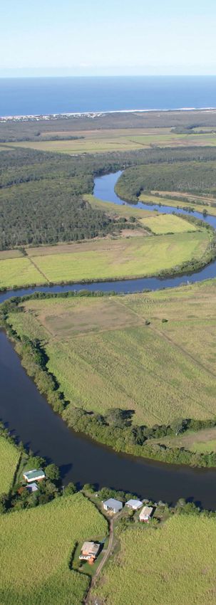
4 Sunshine Coast Waterways and Coastal Management Strategy 2011-2021
Section 1
                                    Executive Summary

Sunshine Coast Waterways and Coastal Management Strategy 2011-2021   5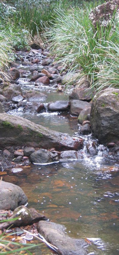
1          Executive summary
The Sunshine Coast Council (Council) is committed             The role of the Strategy is to:
to the effective management of its waterways and
                                                              Inform        Council planning and operational activities
coastal foreshores. Council’s corporate vision is
                                                                            and the development and implementation of
for the Sunshine Coast to be 'Australia’s most
                                                                            the new Sunshine Coast planning scheme.
sustainable region – vibrant, green, diverse'.
Healthy waterways and foreshores are a critical               Guide         Council decision making and
component of this vision and the Corporate Plan                             community initiatives.
2009-2014 identifies these as a high priority.1
                                                              Drive         a range of strategies and actions that will
To assist in achieving its vision, Council has prepared the                 deliver the vision.
Sunshine Coast Waterways and Coastal Management
                                                              Engage        the community and key stakeholders to
Strategy (the Strategy), which outlines key values,
                                                                            build and consolidate the partnerships and
challenges and strategic directions to guide future
                                                                            resources required to make a difference.
planning and implementation.

                                                              The Sunshine Coast’s waterways and coastal
                                                              foreshores include:
                                                              •    five major catchment areas: Maroochy and
                                                                   Mooloolah Rivers, Pumicestone Passage and its
                                                                   tributaries and the headwaters of the Mary and
                                                                   Stanley Rivers (see Figure 2.1). The Sunshine Coast
                                                                   region also includes a small section of the southern
                                                                   headwaters of the Noosa River (see Map 7.1)
                                                              •    a variety of permanent and intermittent (i.e.
                                                                   temporary) wetlands
                                                              •    a diverse range of ecosystems and fauna
                                                              •    coastal lagoons including Stumers Creek,
                                                                   Currimundi Lake, Coondibah Creek and Tooway
                                                                   Creek and other coastal streams
                                                              •    numerous constructed lakes, ponds and canals
                                                              •    approximately 130 kilometres of coastal foreshores
                                                                   stretching from Bribie Island to Coolum, including
                                                                   beaches, dune systems, rocky headlands,
                                                                   Mudjimba Island and near-shore marine
                                                                   environments.

                                                              Waterways and coastal foreshores are valuable assets
                                                              that provide multiple environmental, social and economic
                                                              benefits. The Sunshine Coast’s waterways include unique
                                                              and valuable aquatic ecosystems and play a major role
                                                              in sustaining terrestrial environments. Moreover, they are
                                                              fundamental to the coastal lifestyle that we all enjoy and
                                                              they support many of the industries that contribute to the
                                                              Sunshine Coast’s economy.

                                                              1
                                                                Sunshine Coast Council has adopted a new Corporate Plan
                                                              2014-2019 post the adoption of this Strategy in 2011. Refer to
Grey mangrove (Avicennia marina)                              Council’s website for updated details.

6      Sunshine Coast Waterways and Coastal Management Strategy 2011-2021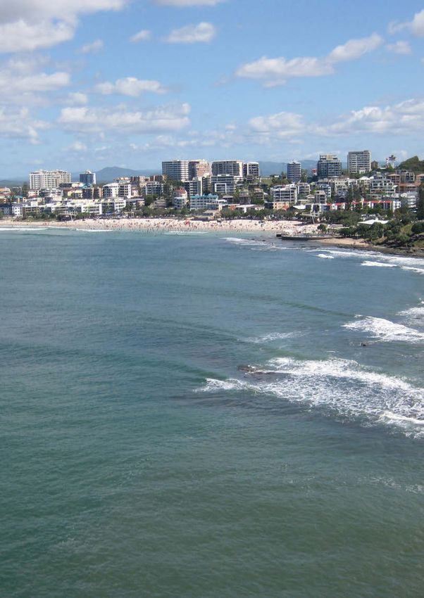
Our waterways and coastal foreshores are under                 determine community confidence and maintain the
pressure from a range of management challenges                 efficiency and effectiveness of investments. This process
including population growth and climate change.                will allow the Strategy to be reviewed and modified where
These challenges have potentially serious environmental,       necessary to ensure that management initiatives continue
economic and social consequences for a community               to address relevant issues.
highly reliant on these assets. These challenges are
important considerations when developing waterway
and coastal management initiatives to maintain healthy
waterways and coastal foreshores, and the businesses
that rely on them.

The Strategy provides a framework and direction for the
management of natural waterways, constructed water
bodies and coastal foreshores. Because they are inherently
different, each of these three water types is addressed
separately and each has its own vision, principles,
objectives and strategic outcomes. The vision of the
Strategy is that:

The Sunshine Coast’s
waterways and coastal                                          Natural waterway, Mary River

foreshores are ecologically
healthy, well-managed assets
that underpin our livelihoods
and lifestyles.
Major deliverables under this Strategy include the
development of:
•    holistic and integrated catchment and estuary
     management plans for each of the Sunshine Coast’s
     catchments
•    marine zones for the Maroochy and Mooloolah River
     estuaries and Pumicestone Passage
                                                               Constructed water body, Mooloolaba Canals
•    a total water cycle management plan for the
     Sunshine Coast
•    a management framework and associated strategic
     asset management plan for constructed water
     bodies
•    a coastal land management plan for the Sunshine
     Coast and associated shoreline erosion management
     plans covering the entire coastline.

Implementation of the Strategy will draw upon and
consolidate the strengths of past waterways planning
and on-ground achievements, while respecting
differences in catchment pressures and waterway
health. Implementation will also incorporate a monitoring,
evaluation and reporting program, which is crucial to          Coastal foreshore, Mudjimba

                                           Sunshine Coast Waterways and Coastal Management Strategy 2011-2021         7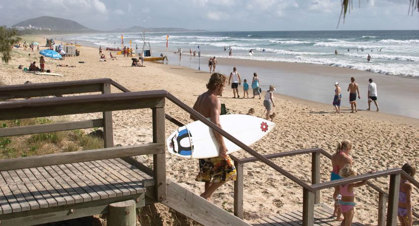
8 Sunshine Coast Waterways and Coastal Management Strategy 2011-2021
Section 2
                                                    Background

Sunshine Coast Waterways and Coastal Management Strategy 2011-2021   9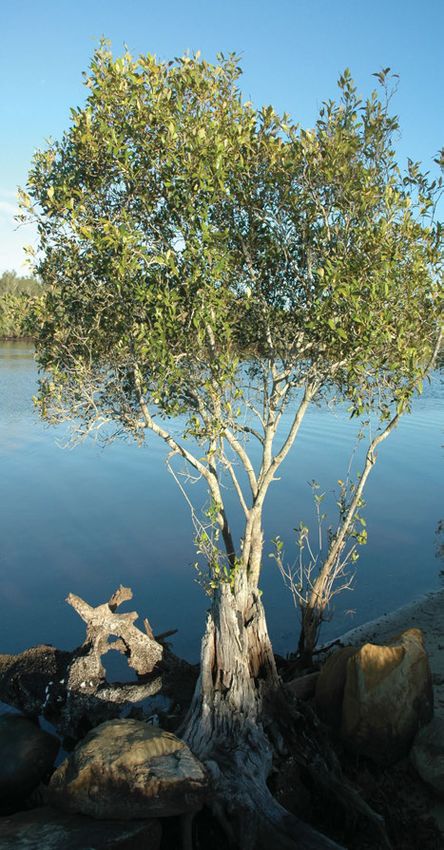
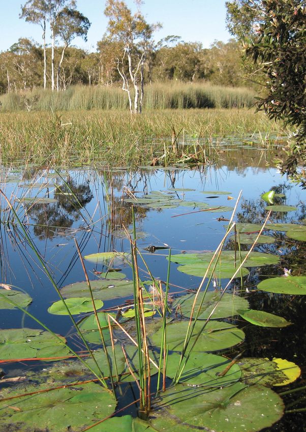
2 Background
The Sunshine Coast’s waterways and coastal 2.1 Waterways and coastal
foreshores (Figure 2.1) are central to the area’s
foreshores at a glance
relaxed, water-based lifestyle, wherein surfing,
fishing and swimming are popular leisure activities. A summary of Sunshine Coast waterways (including
The Sunshine Coast community relies on these natural waterways and constructed water bodies) and
coastal foreshores, including definitions and their spatial
assets, which attract millions of visitors each year.
extent follows.
As such, the health of our waterways and coastal
foreshores is critical to the local economy and the
Natural waterways
livelihoods and lifestyles of residents.
Natural waterways are defined as watercourses, lakes
and wetlands, including their beds, banks and adjoining
buffers, where:
• watercourses are freshwater or tidal rivers, creeks or
other streams in which water flows permanently or
intermittently, in a natural or modified channel, or in
an artificial channel that has changed the course of
the stream
• lakes are wide, open-water ecosystems that are
recharged by watercourses or groundwater
• wetlands are vegetated, swamp- or marsh-like
ecosystems that are permanently or intermittently
inundated by water.
Natural waterways are important landscape elements
which provide a range of critical natural functions,
including fauna movement, water, sediment and nutrient
supply to streamside, floodplain and coastal ecosystems,
habitat for aquatic and streamside biodiversity, and
shaping the landscape itself. Natural waterways also
support a range of recreation and leisure activities and
are important to various industries that contribute to the
Sunshine Coast economy.
Management of natural waterways is typically undertaken
at a catchment scale. The Sunshine Coast includes all or
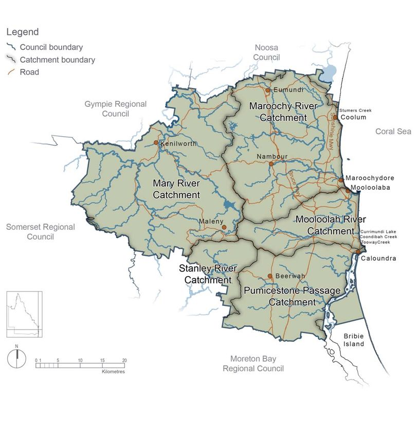
part of the catchments of five major waterway systems:
the Maroochy, Mooloolah, Mary and Stanley Rivers and
the Pumicestone Passage (see Box 1, Table 2.1, Section
7 – Map 7.1, Map 7.2). The Sunshine Coast region also
includes a small section of the southern headwaters of
the Noosa River catchment. Subcatchments within each
of these catchments are represented in Section 7 (Map
7.3 – 7.7). These maps also identify subcatchments of
coastal streams which flow directly to the Coral Sea
and do not impact on waterway health of the major
catchments with which they are associated.
Gheerulla Creek, Mary River
10 Sunshine Coast Waterways and Coastal Management Strategy 2011-20211
4
2
5
3
Figure 2.1: Waterways and coastal foreshores of the Sunshine Coast
Numbers correspond to information on the respective catchments provided in Box 1 (see page 12).
Sunshine Coast Waterways and Coastal Management Strategy 2011-2021 11Box 1: Major Sunshine Coast Catchments
1 Maroochy River The Maroochy River system dominates the central Sunshine Coast. It drops quickly from its
catchment headwaters in the Blackall and Mooloolah Ranges, onto a large broad floodplain dominated
by farmland and sugar cane before reaching the sea at Maroochydore. Parts of the upper
estuary are denuded of riparian vegetation whereas the middle estuary is flanked by healthy
paperbark wetlands and Wallum heath.
2 Mooloolah River The Mooloolah River is a smaller river, with its headwaters in the Mooloolah Range. The
catchment River passes through rainforest and natural bushland, agricultural and grazing lands, and
urban development. The lower reaches have been modified for canal estates and a marina
supporting intensive boating, fishing and tourism activities.
3 Pumicestone The Ramsar-listed Pumicestone Passage is a long, tidal waterway, enclosed between the
Passage mainland and Bribie Island. The Passage receives inflows from a network of creeks (Bells,
catchments Halls, Coochin and Coonowrin) which have their headwaters in the D’Aguilar Ranges, and
pass through native bush, forestry, pine plantations, grazing, horticulture and urban areas.
4 Mary River The Mary River is one of the most environmentally and economically diverse catchments
catchment in Queensland supporting a range of activities including agriculture and tourism. Its
headwaters are in the Conondale and Blackall Ranges and it flows northwards for hundreds
of kilometres to the Great Sandy Strait, influencing the coastal environment of Hervey Bay
and ultimately the Coral Sea. Large areas of the catchment are protected natural areas,
such as Conondale National Park and the catchment supports several iconic threatened
species: the Mary River turtle and cod and Queensland lungfish.
5 Stanley River The Stanley River headwaters are in the foothills of the Great Dividing Range and the
catchment Conondale Range, where large areas of land remain in a relatively natural state. The
catchment contributes substantial quantities of water to the Brisbane supply through its
impoundment at Somerset Dam.
Table 2.1: Summary statistics for the Sunshine Coast’s major river catchments.
Catchment land-use*
Catchment Total Percentage of Percentage Remnant Rural Urban
catchment catchment in of Sunshine vegetation (%) (%)
area Sunshine Coast Coast area (%)
(km2) (%) (%)
Maroochy River 632 100 28 31 52 17
Mooloolah River 223 100 10 29 26 45
Pumicestone 1207 36 20 25 59 16
Passage
Mary River 9434 12 37 48 50 2
Stanley River 7572 1 5 38 62 0
* South East Queensland Regional Plan projection
12 Sunshine Coast Waterways and Coastal Management Strategy 2011-2021Constructed water bodies Coastal foreshores
Constructed water bodies (CWBs) are defined as Coastal foreshores include the near shore marine
artificial waterways2 including canals, where: environment, beaches, dunes, rocky headlands,
• Artificial waterways are artificial channels, lakes or coastal lagoons, backshores, and river mouths.
Coastal foreshores are a component of the coastal
other bodies of water. CWBs specifically exclude
zone (Section 7 – Map 7.8).
sedimentation basins, stormwater treatment
wetlands, water supply infrastructure and The Draft Queensland Coastal Plan 2009 provides
agricultural water bodies a definition of the coastal zone which includes
• Canals are artificial waterways connected, or Queensland’s coastal waters (3 nautical miles from low
intended to be connected, to tidal water, and from water) and land below 10 m Australian Height Datum
which boating access to the tidal water is not or 5 km from the coast (which ever is greater). Where
hindered by a lock, weir or similar structure. appropriate, this zone will be considered as part of
coastal foreshore management, however, it is noted
Large CWBs typically result from land reclamation that the management and regulation of areas of high
activities associated with urban developments. environmental value (e.g. reefs) and fish populations
CWBs not primarily resulting from land reclamation are within the coastal zone are the responsibility of the
typically created during the rehabilitation of resource Queensland government.
extraction pits (e.g. after sand or gravel mining), or are
The Sunshine Coast area includes approximately 130 km
constructed as landscape features (small to medium of coastal foreshore consisting of numerous world class
sized water bodies). beaches interspersed with a small number of iconic
Management responsibilities for most large water rocky headlands. The coastline is one of the area’s major
tourism drawcards with millions of visitors flocking to the
bodies are generally transferred from developers to
Sunshine Coast every year to enjoy the clean white,
Council. In 2010, the Sunshine Coast Council manages
sandy beaches.
approximately 87 constructed ponds and lakes and
approximately 52 kilometres of canal, or canal-like, The coastal foreshores also include the Pumicestone
water frontage. In addition, under existing development Passage. This barrier-lagoon estuary is a wetland of
commitments, it is estimated that approximately 12 international importance in accordance with the Ramsar
kilometres of constructed water frontage are likely to be Convention, offering a protective haven for migratory
transferred to Council for management in the near future. shorebirds, dugongs, marine turtles and dolphins. The
tidal wetlands of the Passage are protected as part
of the Moreton Bay Marine Park. The area is culturally
significant for local indigenous people, confirmed by the
large shell middens along the foreshores.
2
Based on definitions in the Coastal Protection and The Sunshine Coast foreshore also features a number
Management Act 1995, but also including artificial of coastal lagoons which typically have high scenic and
ponds less than 5000 m2 environmental values.
Constructed water body, Mountain Creek Mudjimba Beach
Sunshine Coast Waterways and Coastal Management Strategy 2011-2021 132.2 What are healthy waterways and coastal foreshores?
Healthy natural waterways are ecosystems that have Healthy communities
good water quality, balanced aquatic processes (rates Healthy waterways and coastal foreshores are
of plant and algal growth), are well vegetated with native central to the Sunshine Coast’s culture, sense of place
riparian species (which stabilise banks and provide and unique character. They are easily accessible and
habitat for terrestrial fauna), a variety of in-stream provide residents and visitors with recreational and
structures that provide aquatic habitat, and a diverse relaxation opportunities, from active water sports to more
range of native plants and animals. peaceful pastimes such as fishing, sailing, picnicking
The ecological condition or 'health' of Sunshine Coast and canoeing.
waterways varies between catchments (see Table 2.2).
This variation is due to a number of catchment-specific
factors, including the extent and condition of natural
vegetation, catchment land use and local climate.
Table 2.2: Sunshine Coast freshwater and
estuarine report card grade
Ranges from minimum to maximum, 2002 to 2013
(EHMP, 2010).
Freshwater Estuarine
Catchment Grade Grade
Maroochy River C- to C+ D to C Morning exercises on the river
Mooloolah River C to B C to A- Valuable waterways
Pumicestone Passage C- to B+ D+ to A- Healthy waterways and coastal foreshores are vital to the
maintenance and growth of local industries, including
Stanley River C+ to B+ n/a tourism, agriculture and fishing, which contribute
significantly to the local economy. Tourism alone is a
Mary River B* n/a
key economic driver on the Sunshine Coast, which
Source: Healthy Waterways regional Ecosystem Health provides a ‘playground’ within South East Queensland
Monitoring Program (EHMP)* denotes a value extrapolated from
through its diversity of leisure, tourism and recreational
a limited dataset collected from 2005-2007 (MSC, 2008)
opportunities.
A = Excellent, B = Good, C = Fair,
D = Poor and F = Fail (very poor) Ecosystem services
Healthy waterways and coastal foreshores form vital
For this strategy, healthy constructed water bodies components of the Sunshine Coast’s biodiversity
are well managed assets that balance reasonable network – they are the 'arteries' of the landscape.
service levels and risk mitigation, with consideration of This natural infrastructure provides numerous services
community expectations. Healthy coastal foreshores are to the community such as clean drinking water, irrigation
considered to have a well vegetated dune system of water for agricultural activities, wastewater disposal,
native species that provide unique habitat and protect flood control, soil formation and climate regulation.
the adjacent built environment. They have an adequate
beach area and good water quality, and a diverse range Climate change resilience
of marine and inter-tidal plants and animals.
The health of waterways and coastal foreshores is critical
Healthy waterways and coastal foreshores not only to maintaining resilience to environmental change;
contribute to healthy communities, they also support healthy waterways have a greater capacity to recover
the local economy, offer a range of ecosystem services, or 'bounce back' after a disturbance such as drought,
and are more resilient to climate change than flood or bushfire. This resilience is likely to become
unhealthy environments. more important given the rapid environmental changes
predicted as a result of global climate change.
14 Sunshine Coast Waterways and Coastal Management Strategy 2011-20212.3 Legislative and policy framework
2.3.1 International, federal and state framework
Over 40 pieces of legislation, and more than 80 Nature Conservation Act 1992
policies, govern waterway and coastal management
Public Health Act 2005
across Queensland including the Sunshine Coast. Key
international, federal and state legislation and policies Sustainable Planning Act 2009
are listed below. Transport Operations (Marine Safety) Act 1994
International agreements Vegetation Management Act 1997
Convention on Wetlands of International importance Water Act 2000
(Ramsar Convention)
Draft Queensland Coastal Plan 2009
Bilateral agreements between Australia and China, Japan Environmental Protection (Water) Policy 2009
and Republic regarding migratory birds
Marine Parks (Moreton Bay) Zoning Plan 2008
Federal legislation and policies Our Plan, the South East Queensland Traditional
Environment Protection and Biodiversity Owner Cultural Resource Management Plan (2008)
Conservation Act 1999
South East Queensland Healthy
National Water Quality Management Strategy Waterways Strategy (2007-2012).
National Water Initiative State Planning Policy (Healthy Waters) 2010
South East Queensland Natural Resource
State legislation and policies and other plans Management Plan 2009-2031
Aboriginal Cultural Heritage Act 2003
South East Queensland Regional Plan 2009-2031
Coastal Protection and Management Act 1995 South East Queensland Water Strategy 2010
Environmental Protection Act 1994 Water Resource (Mary Basin) Plan 2006
Fisheries Management Act 1994 Water Resource (Moreton) Plan 2007
Mudjimba Beach
Sunshine Coast Waterways and Coastal Management Strategy 2011-2021 152.3.2 Sunshine Coast Council
policy framework
The Sunshine Coast Council’s Corporate Plan 2009-20143
outlines eight themes that the organisation will pursue to
help achieve its vision to be 'Australia’s most sustainable
region – vibrant, green, diverse'. The eight themes are
listed below:
Innovation and creativity
Robust economy
Social cohesion
Health and wellbeing
Managing Growth
Ecological Sustainability
Accessibility and Connectedness
Great governance
Healthy waterways and coastal foreshores are identified
as a priority within the Ecological Sustainability theme
and associated policy framework.
In response to this priority, the strategy provides a
framework for managing the Sunshine Coast’s natural
rivers, wetlands and lakes, its constructed ponds, lakes
and canals and its coastline, over the next 10 years.
The Strategy does not directly address the management
of drinking water storages or supply, farm dams,
groundwater or wastewater treatment as council has
no jurisdiction over these. Flooding is addressed in a
separate background paper.
The preparation of the Sunshine Coast Planning Scheme
including the strategic framework, codes, policies
and other elements that are relevant to the protection
of natural waterways and coastal foreshores, and the
management and development of constructed water
bodies, will also be informed by the Strategy.4
The implementation of the Strategy will contribute to the
delivery of Ecological Sustainability and will integrate
closely with other policy areas including biodiversity,
climate change and peak oil, economic development,
open space, sport and active recreation and rural futures
through its implementation.
3
Sunshine Coast Council has adopted a new Corporate Plan
2014-2019 post the adoption of this Strategy in 2011. Refer to
Council’s website for updated details.
Canelands, Maroochy River
4
The new Sunshine Coast Planning Scheme was adopted by
Sunshine Coast Council and came into effect on 21 May 2014.
16 Sunshine Coast Waterways and Coastal Management Strategy 2011-2021Table 2.3: Examples of integration with other policy areas
Policy Area Examples of Integration
Biodiversity protection, maintenance and improvement of aquatic biodiversity
recognition of the importance of waterways and riparian vegetation in connecting areas
of native vegetation
informing land acquisition and landscape-scale rehabilitation programs
guiding the management of pest aquatic plant and animal species
Climate Change and consistent use of climate change data, particularly in relation to coastal management
Peak Oil use of vulnerability assessments to inform climate change actions and the coastal land
management plan
climate change adaptation for aquatic environments
Economic Development balancing economic development initiatives with the need to protect our waterways and
coastal foreshores
providing economic data for development of catchment and estuary management plans
Open Space recognition of waterways and coastal foreshores as an important component of the
open space network
alignment of waterway and coastal foreshore management activities with recreational
elements of open space planning
providing sufficient public access to waterways and coastal foreshores
Sport and Active ensuring management solutions for improving and expanding on-water access for on-
Recreation river water sports are considered in the marine zone planning
Health and Wellbeing recognition of healthy waterways and coastal foreshores as an element of the wellbeing
of Sunshine Coast residents
Rural Futures ensuring that development and sustainable enterprises do not adversely impact on
environmental features such as natural waterways and water quality
conserving river or creek bank vegetation in order to maintain ecosystem services,
native habitat connectivity and water quality protection
supporting rural landholders in the restoration of riparian vegetation and the reduction
of agricultural pollution and erosion through environment grants
Sunshine Coast Waterways and Coastal Management Strategy 2011-2021 1718 Sunshine Coast Waterways and Coastal Management Strategy 2011-2021
You can also read