RINGKASAN EKSEKUTIF PASIR PUTEH BANDAR PERINDUSTRIAN ISLAM - JAJAHAN PASIR PUTEH 2035 (PENGGANTIAN) - PLANMalaysia
←
→
Page content transcription
If your browser does not render page correctly, please read the page content below

RINGKASAN
         EKSEKUTIF
        DRAF RANCANGAN TEMPATAN
          JAJAHAN PASIR PUTEH
          2035 (PENGGANTIAN)

PASIR PUTEH BANDAR PERINDUSTRIAN ISLAM
Laporan ini disediakan untuk :

                            Majlis Daerah Pasir Puteh

                                  Disediakan oleh :

    (Jabatan Perancangan Bandar dan Desa)    (Jabatan Perancangan Bandar dan Desa Negeri Kelantan)

                                Dengan kerjasama :

    ‐

•

•

•

                                     Oktober 2021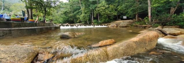
1

2

3

5

7

9

10

21

1
1
2
3
2

•

•

•

3

                                                                                 •
                                                                                 •

                                                                                 •

                                                                                 •
                                                                                 •
                                                                                 •

                                                                                 •
                                                                                 •
                                                                                 •
                                                                                 •

                                                                                 •

                                          Tumpat

            THAILAND
                                              Kota Bharu
                                 Pasir Mas                 Bachok

                                                        Pasir Puteh
                                                         (Ditadbir
                                Tanah                      oleh
                                Merah                     MDPP)
                                              Machang

                       Jeli

                                                                    Terengganu
                                          Kuala Krai
    Perak

                               Kelantan

                               Gua
                              Musang
4
Ke Kota Bharu UTARA
Ke Bachok
JAJAHAN BACHOK
LAUT CINA
SELATAN
LKIM
TOK BALI
BANDAR
PASIR PUTEH
Ke Kuala
Besut
TUDM Gong
MARDI
Kedak
Laut China Selatan
Tumpat
Kota Bharu
THAILAND
Bachok
Pasir
Mas
Pasir
Puteh
Ke Kuala
Tanah
JAJAHAN Merah Machang
Besut
Ke Jertih /
Kuala Terengganu
Jeli
MACHANG Ke Grik /
Perak Kuala
Perak Krai
Terengganu
KELANTAN
Ke Machang DAERAH BESUT
Gua Musang
Ke Kuala
Lipis
Pahang
PELAN KUNCI
Institusi dan Kemudahan Masyarakat Infrastruktur dan Utiliti Pembangunan Lain Semula Jadi & Vegitasi Lain-Lain
Perumahan Tanah Kosong/Tanah Tidak Sempadan Negeri
Pendidikan Bekalan Elektrik
Diusahakan
Keselamatan Pengairan dan Perparitan Komersial Sempadan Jajahan
Tanah Pembangunan/Komited
Kegunaan Kerajaan/Badan Berkanun Pembetungan Sempadan
Industri Tanah Lapang dan Rekreasi Blok
Kesihatan Pelupusan Sistem Pepejal Perancangan
Pertanian
Keagamaan Bekalan Air Hutan
Kemudahan Awam Pengangkutan/Jalan
Badan Air
Pantai
Laut
5
Ke Kota Bharu UTARA
Ke Bachok
Selising
Bandar
Baru Tok
Tok Bali Bali
Cadangan Pembangunan
MadinatulRiadhah
Cherang
Ruku
•
Padang
Pak Amat
Bandar
Pasir Puteh
Ke
Kuala Besut
Gaal
TUDM
Gong Kedak
Cadangan Stesen ECRL Pasir
Puteh dan jangkaan implikasi
kepada kawasan sekitarnya
Jeram
DAERAH BESUT
Ke Machang
Ke Jerteh

6

•

•

•
     PASIR PUTEH
      WILAYAH
    TRANSFORMASI
      EKONOMI

•

•
7
8
9

                                           CADANGAN        ANGGARAN KOS
                                          KESELURUHAN      KESELURUHAN

                                         217               RM 8.6
                                                           Billion

        Projek Flagship /             Projek Utama              Projek                Kajian
        Berimpak Tinggi                  Jajahan               Tempatan              Lanjutan

                8                         59                    131                    19
            PROJEK                       PROJEK                 PROJEK                KAJIAN

        RM 4.6 Billion           RM 613.55 Juta            RM 3.4 Billion        RM 22.1 Juta

         ENABLER   QUICK WIN         ENABLER   QUICK WIN   ENABLER   QUICK WIN   ENABLER   QUICK WIN

            8        -               14         45         39         92             19       -

    •                            •                         •                     •
    •
                                 •                         •

    •

    •                            •

                               ENABLER
10
Pelabuhan Industri Swasta (Penubuhan melalui
Kategori Pelabuhan
Merchant Shipping Ordinance 1952)
Pelabuhan Industri menyedia perkhidmatan
Fungsi Pelabuhan pengkalan bekalan, aktiviti industri huluan
(upstream) berkaitan perikanan, petroleum &
gas dan pembaikan kapal
Jumlah Keluasan: 320 Hektar
Keluasan Pelabuhan
• Breakbulk yard
• Pengkalan Bekalan Utama bagi Operasi
Carigali Petroleum & Gas di kawasan
MTJDA (290 hektar)
• Terminal Pelancongan & Transit bagi Cruise
Percutian (10 Hektar)
Indo-China, ASEAN, Perairan Laut China
Wilayah Perdagangan Selatan dan Teluk Siam
FASA 1 FASA 2 FASA 3
2016-2030 2031-2045 2046-2060
• •
• •
• •
• •
•
• •
• •
•
•
•
•11
PETUNJUK
Industri
Pembangunan Bercampur
Komersial
Institusi dan Kemudahan PETUNJUK
Masyarakat
Tanah Lapang dan Pembangunan Bercampur
Rekreasi
Institusi dan Kemudahan
Masyarakat
• •
•
•
•
•
•
• •
•
•
•
•
•
•
•
•12
•
•
•
•
Laluan ECRL yang sedang
• dibina di Pasir Puteh
• (April 2021)
Sumber : Souther Corridor
Malaysia
•
•
•
•
•
Pejabat Pengurusan Projek ECRL di Pasir
Puteh (April 2021)
Sumber : Souther Corridor Malaysia13
Tapak
Cadangan
Persimpangan Wakaf Pengkalan Kubor
Lincong
LEBUHRAYA PANTAI TIMUR 3
Persimpangan
keluar
LEBUHRAYA TIMUR-BARAT
LALUAN PENYAMBUNGAN
dicadangkan
Penghubung ke di Gong Kulim,
74.30 KM
15.3 KM
Pelabuhan dan Pasir Puteh
Kawasan
Perindustrian
Tok Bali
Rezab Jalan R4-
40 Meter
Persimpangan Jalan Gemuruh,
Persekutuan 189 Kuala Terengganu14
UTARA
1 U
Contoh Ilustrasi Pusat Kesenian Pasir Puteh
1
2
z Contoh Ilustrasi Galeri Tok Janggut
3
2
Contoh Ilustrasi Pusat Informasi Pelancongan
4
3
4
Contoh Pusat Hasil Kraftangan15
JAJAHAN Ke Kota PETUNJUK:
Bharu Jalan
KOTA Ke
A1 BHARU JAJAHAN Bachok Sungai (Semula Jadi)
BUKIT BACHOK Tali Air & Saliran
A2 JAWA Pertanian
Sempadan Negeri
A3 Sempadan Jajahan
BUKIT
A4 ABAL UTARA
A5
A1
PADANG
A6 D2
PAK AMAT SEMERAK
BANDAR A2
A6 PASIRPUTEH
A7 D1
D3
A8 A4 A3
A5
A7
A9
A8 A9 D4 DAERAH
A10
BESUT
A11 Tumpat
Laut China S elat an
KotaBharu
A10 A11 THAILAND
GONG
Bachok
Pasir
Mas
BUKIT Pasir
JAJAHAN DATOK
Puteh
Ke Kuala
Tanah Besut
AWANG
Merah Machang Ke Jertih /
Kuala Terengganu
MACHANG
Jeli
JERAM
Ke Grik /
Perak
Kuala
Krai
Perak Terengganu
Ke
D1 Ke Jerteh KELANTAN
Machang GuaMusang
D2
PELAN KUNCI
D3
Jejak Eko & Agro
D4 A3 Jejak Eko & Agro
A4 D1 A2 A1
A4 D1 A3 A2 A1
Taman Pusat Anyaman Taman Tema Eko Lancong Bukit
Warisan Mengkuang Nik Wi Bakau Peraksi
Taman Pusat Anyaman Taman Tema Eko Lancong Bukit
Warisan Mengkuang Nik Wi Bakau Peraksi
A5 A6 D2 D3 A7
A5 A6 D2 D3 A7
Taman Bonsai Taman Ternakan Ladang Tenusu Jeram
Mahkota LembuTenusu Jeram Mengaji Mengaji
Taman Bonsai Taman Ternakan (Lot 778) Ladang Tenusu
Lembu Jeram
Mahkota Tenusu (Lot 778) Jeram Mengaji Mengaji
A8
D4 A11 A9
D4 A11 A10 A8
A9
Hutan Bunga Ilustrasi Papan Informasi
MARDI Jeram Bukit Batu
Simpan Balai / Raflesia Jejak Eko dan Agro
Pasir Puteh Pasu
Chabang
Jajahan Pasir Puteh
Lata DO
TamatMARDI Jeram Hutan
Tongkat Bukit Batu
Bunga
Pasu Simpan Rafflesia
Pasir Puteh Balai/
Chabang
Tamat Tongkat
Lata DO
Lata DO
Sumber : Lawatan Tapak Ilustrasi Papan Informasi Jejak Eko
dan Agro Jajahan Pasir Puteh16
Kod Cadangan Kod Cadangan
3 Lebuhraya Kota Bharu - Kuala Krai (Lebuhraya Rakyat) 11 Naik taraf Jalan Negeri D7
4 Jalan pintas baru dari Jalan Negeri D7 ke Jalan Persekutuan 482 12 Naik taraf Jalan Negeri D136 (Jalan Selising – Kok Lanas) dari Selising ke Bukit Merbau
13 Naik taraf Jalan Negeri D159 (Jalan Jeram Pasu)
Jalan baru ke Bandar Sukan Madinatul Riadah dari Jalan Selising - Kok Lanas
5
(Jalan Negeri D136) dan Jalan Tok Bok 14 Naik taraf Jalan Negeri D141
6 Jalan baru dari Jalan Persekutuan 482 ke Jalan Pasir Puteh – Kg. Tok Bali 15 Naik taraf jalan dari Jalan Negeri D141 ke Jalan Persekutuan 189
16 Naik taraf Jalan Negeri D163
Naik taraf Jalan Persekutuan 3 dari Kampung Pak Badol (KM 23) melalui
7
Kampung Banir Belikong (KM 30) ke Kampung Sri Aman (KM 38) 17 Naik taraf Jalan Kg. Telaga Papan
8 Naik taraf Jalan Persekutuan 3 dari Bukit Yong ke simpang Wakaf Lichong 18 Naik taraf Jalan Kg. Wakaf Bunut ke Kg. Saring
9 Naik taraf Jalan Persekutuan 189 19 Naik taraf jalan di Kg. Gong Datuk (Gaal - Sg. Petai)
20 Naik taraf Jalan Lapangan Terbang dari Jalan Semerak ke Pangkalan Udara Gong Kedak
10 Naik taraf Jalan Persekutuan 48217
•
•
•
•18
•
•
•
•
Petunjuk
•
Potensi Kawasan Pengukuhan Imej Bandar
Elemen Imej Bandar
Menara Tinjau
1 5 DMR – Duduk – Makan- Rehat
Mercu Tanda/ Titik Tumpuan
Potensi Laluan
2 Jambatan Pejalan Kaki
6 Urban regeneration
•
Nodus 3 Replika Jong
Bangunan Usang Peningkatan dan Pengindahan
7
Daerah Bandar / 4 Persimpangan
“Pasir Puteh Big Step”
‘Urban District’ Bangunan Bernilai Warisan
•
•
Membawa kembali
Kaki lima semasa tidak
kehijauan di dalam bandar
lagi sesuai dengan skala
dengan memberi ruang
yang kecil. Ianya perlu
untuk tanaman sebagai
diperluaskan bagi
hiasan dan teduhan
kelegaan pengunjung
Penggunaan pokok bucida Menaik taraf sistem
dan bunga kertas dari perparitan dalam bandar
pelbagai warna akan supaya ruang di antara
meningkatkan imej bandar kaki lima dan jalan dapat
di gunakan sepenuhnya
Keadaan Semasa Bangunan Di Pemilihan warna cerah
dan kebersihan hendaklah
Jalan Pasar Lama di utamakan bagi
mengekalkan imej untuk
menampakan keluasan
26 Ogos 2020 dan keselesaan ruang
A
B
C
Mereka-bentuk semula Mengekalkan karektor
jalan dalam bandar supaya bangunan kayu dengan
ianya lebih mesra penambah-baikan fasad
pengguna
D
Mengekalkan ‘on street Memamparkan fasad
parking’ bagi kemudahan bangunan yang tidak
pengguna bagi menggunakan papan iklan
menampung daya tahan yang besar
aktiviti komersial
PETUNJUK Mengaplikasi reka bentuk
universal/ ‘universal
design’ bagi kemudahan
Papan iklan disediakan
mengikut skala bangunan
dan manusia / ‘human
semua golongan pengguna scale’
di bandar
A Papan tanda yang lebih kecil bagi membantu legibiliti dan identiti perniagaan
B Mengekalkan bahan binaan kayu dan ciri-ciri bangunan yang ada
C Penyediaan ‘awning’ bagi memberi keselesaan ruang kaki lima
Menyediakan perabut jalan yang mengikut skala pejalan kaki dan dilengkapi dengan info
D petunjuk jalan19
UTARA
•
• •
•
• •
Petunjuk
Zon Laluan Persaudaraan
Trail Laluan
Pintu Masuk
‘Focal Point’ / Titik Tumpuan
Axis
Ilustrasi Laluan Persaudaraan Pachakan Sempadan Negeri20
JUMLAH PENDUDUK MELEBIHI
150,000
HASIL TAHUNAN MELEBIHI
RM20 JUTA
KEUPAYAAAN
PERKHIDMATAN
CARTA ORGANISASI MDPP
BANDAR Yang Dipertua
Ahli Majlis
Setiausaha
KEUPAYAAAN
SISTEM PENYAMPAIAN Unit Kewangan Unit Pusat Setempat (OSC) Unit Kejuruteraan
PERKHIDMATAN Unit Perundangan
Unit Perancang Unit
Bandar & Desa Penguatkuasaan
KEUPAYAAAN Unit Pelaburan Unit Pentadbiran Unit Bangunan
PUSAT PERTUMBUHAN
BARU
Unit Teknologi Maklumat
Unit Perlesenan & Unit Penilaian &
Kesihatan Pengurusan Harta
Persekitaran
Unit Korporat
14 Jawatan kosong serta penambahan 10% jawatan Kumpulan A bagi unit-unit di atas21
•
•
• • • • •
•
• •
•
•
•
•
•22
PASIR PUTEH BANDAR PERINDUSTRIAN ISLAM

                 Keterangan Gambar Kulit

Bermula daripada bentuk asas seperti segi empat, segi tiga dan
lengkungan bulatan, serta bentuk asas yang lebih rumit seperti
segi lima (hexagon), dekagon, heptagon dan nonagon, corak
geometri yang unik telah mencapai kemuncak tertinggi di
dalam perkembangan kesenian dan tamadun Islam sejak zaman
berzaman.

Evolusi penggunaan corak geometri ini telah disokong oleh
sumbangan para ilmuan islam yang bijaksana dalam bidang
matematik, astronomi, dan sains dengan menonjolkan
falsafahnya yang tersendiri - iaitu Kesatuan Dalam
Kepelbagaian dan Kepelbagaian Dalam Kesatuan.

Corak geometri islamik yang menggabung dan mencantumkan
bentuk hexagon dan oktagon ini telah dijadikan asas kepada
rekabentuk rajah yang menggambarkan Teras Strategik
Perancangan Bandar Perindustrian Islam Jajahan Pasir
Puteh di dalam memainkan peranannya sebagai Wilayah
Transformasi bagi Negeri Kelantan bagi tempoh
perancangan sehingga tahun 2035.

                      Keterangan Logo

      JPP merujuk kepada Jajahan Pasir Puteh dan bunga
      kertas merupakan bunga rasmi Jajahan Pasir Puteh
This report is prepared for:
Pasir Puteh District Council
(MDPP)
Prepared by:
(Department of Town and Country Planning) (Department of Town and Country Planning Negeri Kelantan)
In Collaboration with :
This Draft of Pasir Puteh District Local Plan 2035 (Replacement) [RTJPP2035 (P)] is being prepared for the planning period until 2035,
replacing the Pasir Puteh District Local Plan 2020 which has expired in 2020.
This Local Plan is prepared in accordance with the provisions of Subsection 16 (1), Town and Country Planning Act 1976 (Act 172)
which states that the local planning authority may at any time, make a proposal for the alteration, cancellation, or replacement of a local
plan.
RTJPP2035 (P) is a document that contains a proposal map and a written statement describing in detail the recommendations of the
Local Authority (Pasir Puteh District Council) regarding physical planning such as land use, environment, infrastructure and utilities,
landscape and traffic.
RTJPP2035 (P) is divided into 3 volumes which explain the following:
Volume 1 contains a written statement, direction & development strategy arranged accordingly to the development thrust.
Volume 2 specifically contains a proposal map consisting of physical development planning zones and a specific schedule
of development activities for the planned zones as well as development guidelines.
Volume 3 describes the management and implementation aspects of the development projects submitted.
These reports will be gazetted as official documents of the Kelantan State Government and used as a guide & main reference on behalf of
the Pasir Puteh District Council (MDPP) and related planning & implementation agencies in implementing proposals, planning control
as well as being a facilitator for the development implementation.
This Executive Summary extracts important sections from the three volumes of the RTJPP2035 (P) report
All rights reserved, no part of the publication of RTJPP2035 (P) report may be reproduced or stored in a retrievable form or transmitted
in any form by any means, whether electronic, mechanical, photocopying, recording or otherwise even without obtaining permission
from PLANMalaysia and Pasir Puteh District Council (MDPP).
October 2021TABLE OF CONTENTS
INTRODUCTION 1
PASIR PUTEH DISTRICT LOCAL PLAN REQUIREMENTS 2035 (REPLACEMENT) 2
AREA PROFILE OF PASIR PUTEH DISTRICT LOCAL PLAN 2035 (REPLACEMENT) 3
THE DEVELOPMENT DIRECTION OF PASIR PUTEH DISTRICT LOCAL PLAN 2035 (REPLACEMENT) 5
LAND USE PROPOSAL MAP FOR PASIR PUTEH DISTRICT 2035
7
OVERALL PROJECT STATISTICS & FURTHER STUDY FOR PASIR PUTEH DISTRICT LOCAL PLAN 2035
(REPLACEMENT) 9
SELECTIVE PROJECTS
10
INVESTMENT DEVELOPMENT APPROVAL PROCESS & PROCEDURE BY FACILITATOR MODEL
CATEGORY 211
INTRODUCTION
The Executive Summary of the Pasir Puteh District Local Plan 2035 (Replacement) ) contains a summary of
excerpts from the Draft Report of the Pasir Puteh District Local Plan 2035 (Replacement).
Details of the Draft of Pasir Puteh District Local Plan 2035 (Replacement) contains three (3) main volumes
consisting of:-
1 Volume 1: Written Statement and Development Strategies
Development Concepts and Strategies
Development Proposal Map
Project Strategies And Proposals
Implementation Actions
2 Volume 2: Map of Proposed Land Use and Development Control
Land Use Zone
Land Use Class
Development Control
Guidelines
3 Volume 3: Project Management and Implementation
Project List and Cost Estimates
Development Facilitator
Geographic Information System (GIS)2
PASIR PUTEH DISTRICT LOCAL PLAN REQUIREMENTS 2035 (REPLACEMENT)
Pasir Puteh District Local Plan 2035 (Replacement) [RTJPP2035 (P)] is an official planning document
made as a replacement after the Pasir Puteh District Local Plan 2020 (gazetted on 20 December 2012
through Kelantan State Gazette No. 2079) expired in 2020.
This is in accordance with the provisions of paragraph 16 (1), Act 172 which states that “The Local
Planning Authority may at any time, make a proposal for the alteration, cancellation or replacement of a
local plan”.
The requirements for the preparation of Pasir Puteh District Local Plan 2035 (Replacement) are as
follows:
Replacing the Pasir Puteh Local Plan 2020 Which Has
1 Already Expired Its Implementation Period
Translating the Global, National, Regional, State and Local
2 Planning and Development Policies & Strategies
3 Coordinating the Changes in Land Use
4 Preserving the Sustainability and the Environment
Preparing Planning Control Documents and Facilitation of
5 Development3
AREA PROFILE OF PASIR PUTEH DISTRICT LOCAL PLAN 2035 (REPLACEMENT)
AREA OF STATE / DISTRICTS
Existing Land Use of Pasir Puteh District 2020
State of Kelantan - 1,502,606.60 hectares
Item Area (Hectares) Percent (%) Pasir Puteh District - 42,513.13 Hectares
Built Up Area 13,064.98 30.73
(JUPEM, December 2020)
Housing 4,590.35 10.80 NUMBER OF DISTRICTS / TOWNSHIP
Commercial 148.99 0.35
8 Districts / 36 Townships
Industry 142.70 0.34
Institutions & Community Facilities 1,859.15 4.37 TOTAL POPULATION
Recreational Facilities & Open Space 12.94 0.03
146,000 People (2019)
Empty land 4,238.70 9.97 Women: 56.2 %
Transportation 1,264.61 2.97 Men: 50.8 %
Infrastructre & Utility 807.54 1.90 DISTRICT BORDERS
Nature & Vegetation 29,448.15 69.27 Bachok District - North
Forest 5,645.66 13.28 Kota Bharu District - Northwest
Machang District - Southwest
Agriculture 22,118.31 52.03
Besut District, Terengganu – Southeast
Water body 1,589.26 3.74
Beach 94.92 0.22 ADMINISTRATION AREA
Amount 42,513.13 100 Pasir Puteh District Council (MDPP)
Tumpat
Main Land Use of Pasir Puteh District 2020
THAILAND
Kota Bharu
Pasir Mas Bachok
Tanah
Pasir
Puteh
(Ditadbir
Nature
Merah oleh
Machang MDPP) 69.27 %
Jeli
Terengganu
Kuala Krai
Perak
Agriculture
52.03 %
Kelantan
Gua
Musang
Built Up 30.73
%
Location Plan of Pasir Puteh District4
To Kota Bharu UTARA
To
Bachok
BACHOK DISTRICT
SOUTH
CHINA SEA
LKIM
TOK BALI
BANDAR
PASIR PUTEH
To Kuala
Besut
TUDM
MARDI Gong
Kedak Tumpat
Laut China Selatan
Kota Bharu
THAILAND
Bachok
Pasir
Mas
Pasir
Puteh
MACHANG
Ke Kuala
Tanah Besut
Merah Machang
Ke Jertih /
Kuala Terengganu
DISTRICT
Jeli
Ke Grik /
Perak Kuala
Perak Krai
Terengganu
KELANTAN
To Machang DAERAH BESUT
Gua Musang
Ke Kuala
Lipis
Pahang
KEY PLAN
Existing Land Use Plan in Pasir Puteh District 2020
Institution and Community Facilities Infrastructure and Utility Other Development Nature & Vegetation Others
Housing Vacant Land / Undeveloped State Border
Institution Electricity Supply
Land
Security / Safety Irrigation and Drainage Commercial District Border
Developed / Committed Land
Government / Statutory Body Use Sewerage Planning Block
Industry Open Space and Recreation Border
Health Facility Solid Waste Disposal
Agriculture
Religious Facility Water Supply Forest
Public Facility Transportation / Road
Water Body
Beach
Sea5
DEVELOPMENT DIRECTION OF PASIR PUTEH DISTRICT 2035
DEVELOPMENT THRUST
GOAL, VISION AND MISSION
Thrust Balanced and Sustainable Spatial Development
1
Physical Planning & Land Use
GOAL Housing & Village Settlements
Pasir Puteh The Islamic Industrial City Institutions & Community Facilities
- Steering for Change 2035
Thrust A Competitive Economy
2
Economic & Demographic Fundamentals
Business & Services
Agriculture & Fisheries
VISION Tourism & Heritage
Pasir Puteh District As An Important Islamic
Thrust Efficient and Integrated Infrastructure,
Industrial City For Kelantan And The 3 Communications and Utilities Development
Surrounding Region
Infrastructure, Utilities & Communications
Communications, Transportation & Traffic
Management
Thrust
MISSION 4 Green Development and Sustainable Environment
Advancing Pasir Puteh District Through Environment, Maintenance & Preservation of KSAS
Transformation Of Industrial And Maritime- Urban Design, Landscape & Recreation
base Economy, Tourism And Agro-based
Thrust Effective and Efficient Governance
Industry 5
Management & Implementation
SPATIAL DEVELOPMENT CONCEPT AND STRATEGIES
Ke Kota Bharu UTARA
High Impact Projects as The two Leading Cities are :
‘Catalyst’ Bandar Pasir Puteh - Main
Ke Bachok
Projects will act as a Administrative and Service Center
‘transformation catalyst’ to Tok Bali Town - administrative
Selising
the economic growth of the area, icon for port , maritime and
district. industrial activities for the State of
Bandar
Baru Tok Kelantan.
Bali
Supported Cities :
Tok Bali
Cadangan Pembangunan
Bandar Baru Tok Bali – industrial
MadinatulRiadhah
Cherang
Ruku
Connecting Axis & Booster
Padang (high impact infrastructure Other Cities - Complement the local
Pak Amat
Bandar project) as catalyst: economic chain.
Pasir Puteh
LPT3 (route and
Ke
Kuala Besut
intersection at Gong Kulim)
ECRL (Pasir Puteh ECRL Complementary and Mutual Support
Gaal route and station and Between Bordering Regions
Mutually Supportive and
TUDM
Gong Kedak
spurline to Tok Bali)
Complementary Tourism
Cadangan Stesen ECRL Pasir
Puteh dan jangkaan implikasi
kepada kawasan sekitarnya East West Highway
Jeram
Extension (ends at Development for Tok Bali/Semerak
Pachakan) and Kuala Besut areas.
DAERAH BESUT
Proposed Development of Provision of Public Facilities with
Ke Machang
Tok Bali Port Shared Capacity for community use
Ke Jerteh6
ISLAMIC INDUSTRIAL URBAN ECOSYSTEM
This strategic thrust is formed in the context of
maintaining the dimensions of the relationship
between:
Man with the creator
Man with the environment
Man with the mankind
This thrust is also an interpretation of Kelantan's
development policy which emphasizes on the basics of
Blessing, Prosperity and Welfare in the aspect of
spatial planning.
MACHINERY DIAGRAM FOR THE
ECONOMIC TRANSFORMATION STRATEGY TRANSFORMATION REGION CONCEPT
Increasing the yield of the primary sector
through the use of technology in agriculture,
fisheries and livestock activities.
High
Impact Port &
Related
Expanding the chain of upstream and Project
Economic Fisheries &
downstream activities through the promotion of Chain Food
Industry
'by product' and 'upstream product' enterprises
related to the primary sector economy operated in
the Pasir Puteh District.
Infrastructure &
Connectivity PASIR PUTEH Tourism
Strengthening the economy of the local Enhancement ECONOMIC Activity
community through direct involvement in the TRANSFORMATION
REGION
development related to the Port of Tok Bali and the
services and support industries involved.
Chain of
Creating a conducive and investor yanfriendly Other Services Local
Economy
investment space. Supporting
Industry
Ensuring the well-being of the local community.7
LAND USE PROPOSAL MAP OF PASIR PUTEH DISTRICT 20358
LAND USE TABULATION FOR PASIR PUTEH DISTRICT 2035
Proposal for 2035
Component
Area (Hectares) Percentage (%)
Built-Up 13,809.43 32.48
Housing 7,693.49 18.10
Commercial 553.52 1.30
Industrial 570.85 1.34
Mixed Development 457.57 1.08
Institutional & Public Facilities 2,078.30 4.89
Transportation 1,806.56 4.25
Infrastructure and Utilities 649.34 1.53
Nature & Vegetation 28,703.70 67.52
Forest 3,155.35 7.42
Agriculture 23,522.19 55.33
Open Space & Recreation 243.27 0.57
Water Body 1,736.14 4.08
Beach 46.75 0.11
Total 42,513.13 100.00
Key Land Use of Pasir Puteh District
30.73% Nature & Vegetation
32.48%
67.52%
69.27 %
Built-Up
Year 2020 Year 20359
PROPOSED PROJECT & FURTHER STUDIES FOR PASIR PUTEH DISTRICT LOCAL PLAN 2035
(REPLACEMENT)
OVERALL OVERALL COST
RECOMMENDATIONS ESTIMATES
217 RM 8.6
Billion
Flagship / High District Main Local Further
Impact Project Project Project Study
8 59 131 19
PROJECT PROJECT PROJECT STUDY
RM 4.6 Billion RM 613.55 Juta RM 3.4 Billion RM 22.1 Juta
ENABLER QUICK WIN ENABLER QUICK WIN ENABLER QUICK WIN ENABLER QUICK WIN
8 - 14 45 39 92 19 -
Flagship Project District Main Project Local Project Further Study
• Large scale projects • Medium scale projects Small & medium Urban research
• Giving a direct impact to • Giving a direct impact to scale projects and non physical
the state & country. the Pasir Puteh District & Meet other activity
• Long term development bordering regions requirements in
• Enabler or catalyst to the • Meet the key Pasir Puteh District
growth of Pasir Puteh requirements in Pasir
District. Puteh District
ENABLER QUICK WIN
Catalyst for the growth / development of Projects that can be completed in a short time
Pasir Puteh District as a whole period and provide immediate benefits10
SELECTIVE PROJECTS
DEVELOPMENT OF TOK BALI INDUSTRIAL PORT
PROJECT CATEGORY: FLAGSHIP
DETAILED REPORT VOLUME 1: PAGE 114-119 & 130
Port Category Private Industrial Port (Establishment
through Merchant Shipping Ordinance 1952)
Industrial Port that provides supply base
Port Function services, upstream industrial activities
related to fisheries, petroleum & gas and
ship repair
Total Area: 320 Hectares
Port Area
A. North Pier: 20 Hectares
• Breakbulk yard
B. South Pier: 300 Hectares
• Main Supply Base for Petroleum & Gas
Exploration Operations in MTJDA Area (290
Hectares)
• Tourism & Transit Terminal for Holiday
Cruises (10 Hectares)
Indo-China, ASEAN, South China Sea and
Trading Region Gulf of Siam
PHASE 1 PHASE 2 PHASE 3
2016-2030 2031-2045 2046-2060
North Pier Supply Base Duty Free Complex & Tourist Terminal
Covering an area of 20 hectares Based on TBSB's master plan of 101 hectares Covering an area of 10 hectares
Breakbulk yard Expansion of the existing supply base zone to 290 Terminal Building
The bulk pier faces the Semerak River as a hectares (additional 189 hectares from the existing Jetty
facility for barges to anchor and unload area) Marina
bulk goods As a supply base for MTJDA's oil rig activities Vacation Cruise
include: • Songkhla
South Pier • Labor supply • Pattaya
• Food • Bangkok
Covering an area of 300 hectares • Treated water • Surat Thani
Has a supply base for petroleum • Excavation machinery & equipment • Nha Thrang
exploration Other potential amenities • Surat Thani / Koh Samui
Government & private agency logistics • Medicine • Sihanoukville (Cambodia)
services • Repair workshop Sailboat / Yatch
The pier faces the sea • Helipad (emergency) Duty free shop for maritime
Requires the construction of a breakwater • Emergency help products and water sports
• Warehouse
• Other related upstream and downstream
services11
SELECTIVE PROJECTS
DEVELOPMENT OF BANDAR BARU TOK BALI & BANDAR TOK BALI
PROJECT CATEGORY: FLAGSHIP
DETAILED REPORT VOLUME 1: PAGE 133-134
PETUNJUK
Industri
Pembangunan Bercampur
Komersial
Institusi dan Kemudahan PETUNJUK
Masyarakat
Tanah Lapang dan Pembangunan Bercampur
Rekreasi
Institusi dan Kemudahan
Masyarakat
Area Area
1,141.00 hectares 165.30 hectares
Coordination of Proposed Land Use Coordination of Proposed Land Use
RKK Bandar Tok Bali 2045
RKK Tok Bali Town 2045
Land Acquisition for Roads
Land Acquisition for BBTB Town Park Key Proposed Land Use
Existing Land Ownership Mixed Development
Community Institutions & Facilities
Development Target
Providing Space for Growth and Development
of Economic Transformation for Pasir Puteh
District
Forming the Bandar Baru Tok Bali
Illustration of Development Conurbation - Port Area to
Bandar Baru Tok
Bali
Support the Economy and Maritime Activities
Creating Employment & Entrepreneurship
Key Proposed Land Use Opportunities for Locals
Industrial Areas
Mixed Development
Residential Area
Coastal Canal Housing
Recreational Area (BBTB Town Park)12
SELECTIVE PROJECTS
ECRL ROUTE WITH STATION, PASIR PUTEH LAND PORT & PASIR PUTEH-TOL BALI SPURLINE ALIGNMENT
PROJECT CATEGORY: FLAGSHIP
DETAILED REPORT VOLUME 1: PAGE 103
Description
The proposed ECRL route, Pasir Puteh ECRL
Railway Station (BP4: Jeram) has been identified as
a key development driver for the district. The
station will also be the beginning of the spurline
line to Tok Bali Port.
Suggested Location
ECRL station at BP4: Jeram
Proposed Spurline Alternative 1
Pasir Puteh-BBTB Industry-North Bulk Pier
21.63 km
3 hubs
Pasir Puteh Depot
BBTB Depot
North Pier
The ECRL route
Proposed Spurline Alternative 2 under construction
Pasir Puteh-Cherang Ruku-South Pier in Pasir Puteh
16.64 km (April 2021)
2 hubs Source : Southern
Pasir Puteh Depot Corridor Malaysia
South Pier
Implementing Agencies
1. Malaysia Rail Link (MRL)
2. Kelantan State Government
ECRL Project
Management Office in
Pasir Puteh(April 2021)
Source : Southern Corridor
Malaysia13
FLAGSHIP PROJECTS
DEVELOPMENT OF MADINATUL RIADAH
PROJECT CATEGORY: FLAGSHIP
DETAILED REPORT VOLUME 1: PAGE 104
Area 320 acres
Component Sports Complex Facilities
Function Main venue for Sukan Malaysia
(SUKMA) event in 2024
Location BP 1: Bukit Jawa
Tapak
Cadangan
SELECTIVE PROJECTS
EAST COAST HIGHWAY 3 & EAST - WEST HIGHWAY LINKING ROUTE
PROJECT CATEGORY: FLAGSHIP
DETAILED REPORT VOLUME 1: PAGE 282-284
Wakaf Lincong Pengkalan Kubor
intersection
EAST – WEST HIGHWAY LINKING
An exit
EAST COAST HIGHWAY 3
junction is
proposed at
Link to Tok Gong Kulim,
74.30 KM
Bali Port and Pasir Puteh
15.3 KM
ROUTE
Industrial Area
Road Reserve
R4- 40 Meters
Federal Route 189 Gemuruh,
intersection Kuala Terengganu14
SELECTIVE PROJECTS
TOK JANGGUT HERITAGE & ARTS COMPLEX
PROJECT CATEGORY: LOCAL PROJECTS
DETAILED REPORT VOLUME 1: PAGE 234
COMPONENTS OF TOK JANGGUT HERITAGE & ARTS COMPLEX
1 Arts Center 2 Tok Janggut Gallery 3 Handicraft Products Center
Among the proposed Among the proposed Among the proposed
components: components: components:
i. Tok Janggut Exhibition i. Handicraft showroom
i. Training and special place
ii. Pasir Puteh Art Room Hall
ii. Handicraft sales kiosk
iii. Art Incubator ii. Tok Janggut Memorial
iv. Show stage and cultural iii. Craft interactive activity
performances iii. Pasir Puteh Tourism room
v. Art and Heritage Gallery Information Center
vi. Mini heritage library (Art
documentation material)
UTARA
1 U
Contoh Ilustrasi Pusat Kesenian Pasir Puteh
1
2
z Contoh Ilustrasi Galeri Tok Janggut
3
2
Contoh Ilustrasi Pusat Informasi Pelancongan
4
3
4
Contoh Pusat Hasil Kraftangan
Illustration of Tok Illustration of Tok
Janggut Historical Janggut Gallery
Signs Exhibition Hall15
SELECTIVE PROJECTS
ECO & AGRO TRAILS OF PASIR PUTEH DISTRICT
PROJECT CATEGORY: LOCAL PROJECT
DETAILED REPORT VOLUME 1: PAGE 238
Ke Kota
Eco Tourism / Adventure, Sports & JAJAHAN
KOTA
Bharu
PETUNJUK:
PETUNJUK:
Jalan
Jalan
Ke
Recreation (Forest & Waterfalls) BHARU JAJAHAN Bachok
Sungai (Semula Jadi)
Sungai (Semula Jadi)
Tali Air & Saliran
BUKIT BACHOK Tali Air & Saliran
A1 Pertanian
Pertanian
JAWA
Sempadan
SempadanNegeri
Negeri
A2 Sempadan
SempadanJajahan
Jajahan
BUKIT
A3 ABAL UTARA
A4
A1
A5
PADANG
D2
PAK AMAT SEMERAK
BANDAR A2
A6 A6 PASIRPUTEH
D1
D3
A7 A4 A3
A5
A7
A8
A8 A9 D4 DAERAH
A9
BESUT
A10 Tumpat
Laut China S elat an
A10 A11
A11 GONG
BUKIT
JAJAHAN DATOK
AWANG
MACHANG JERAM
Agro Tourism Ke
Ke
Jerteh
Machang
D1
D2
D3
Eco & Agro Trail
A4 D1 A3 A2 A1
D4
Taman Pusat Anyaman Taman Tema Eko Lancong Bukit
Warisan Mengkuang Nik Wi Bakau Peraksi
A5 A6 D2 D3 A7
Taman Bonsai Taman Ternakan Lembu Ladang Tenusu Jeram
Mahkota Tenusu (Lot 778) Jeram Mengaji Mengaji
D4 A11 A10 A8
A9
MARDI Jeram Hutan Bunga
Bukit Batu
Pasu Simpan Rafflesia
Pasir Puteh Balai/
Chabang
End Tongkat
Lata DO
Lata DO
Sumber : Lawatan Tapak Illustration of the Eco and Agro
Trail Information Board of Pasir
Puteh Colony16
SELECTIVE PROJECTS
NEW ROADS & ROAD UPGRADES AROUND PASIR PUTEH DISTRICT
PROJECT CATEGORY: DISTRICT MAIN PROJECTS & LOCAL PROJECTS
DETAILED REPORT VOLUME 1: PAGE 284-286
Code Proposal Code Proposal
3 Kota Bharu - Kuala Krai Highway (People's Highway) 11 Upgrade of State Road D7
4 New shortcut from State Road D7 to Federal Road 482 Upgrade of State Road D136 (Jalan Selising - Kok Lanas) from Selising to
12
New road to Madinatul Riadah Sports City from Jalan Selising - Kok Lanas Bukit Merbau
5
(Jalan Negeri D136) and Jalan Tok Bok 13 Upgrade of State Road D159 (Jalan Jeram Pasu)
6 New road from Federal Road 482 to Jalan Pasir Puteh - Kg. Tok Bali 14 Upgrade of State Road D141
Upgrade Federal Road 3 from Kampung Pak Badol (KM 23) through 15 Upgrade the road from State Road D141 to Federal Road 189
7
Kampung Banir Belikong (KM 30) to Kampung Sri Aman (KM 38) 16 Upgrade of State Road D163
8 Upgrade Federal Road 3 from Bukit Yong to Wakaf Lichong junction 17 Upgrade Jalan Kg. Telaga Papan
9 Upgrade of Federal Roads 189 18 Upgrade Jalan Kg. Wakaf Bunut to Kg. Saring
10 Upgrade of Federal Roads 482 19 Upgrade the road in Kg. Gong Datuk (Gaal - Sg. Petai)
20 Upgrade the Airport Road from Jalan Semerak to Gong Kedak Air Base17
SELECTIVE PROJECTS
ACTION PLAN FOR DISASTER RISK AREAS
PROJECT CATEGORY: LOCAL PROJECT
DETAILED REPORT VOLUME 1: PAGE 306
The management structure at the Provision of Infrastructure to specifically Conduct further studies to identify
district level needs to be updated control disaster risks & improve urban disaster risks & appropriate
involving the following security: mitigation measures in the future.
administrative, rescue & emergency Among the further studies
agencies: 1. Provide Tsunami wave detection cameras proposed are:
that can be accessed & analyzed by local
1. Pasir Puteh District Council security agencies 1. Pasir Puteh disaster risk study
2. Pasir Puteh Land & District Office 2. Site for tsunami early warning siren with (general)
3. Kelantan State Health Department an area size of 10x10 for Security Purposes 2. Studies for coastal erosion control
4. Royal Malaysian Police (PDRM) within 300m from the coastal area. The in Pasir Puteh District
5. Malaysian Civil Defense Force suggested locations are around Bisikan Bayu 3. Study of flood risk in Pasir Puteh
(APM) Beach, Tok Bali Beach and Pulau Kambing District
Beach. 4. Birdstrike risk assessment study
6. Fire & Rescue Department of
3. Addition of closed circuit television (CCTV) at Gong Kedak Air Base.
Malaysia (JBPM)
cameras in 'hotspot' areas around Pasir Puteh 5. EIA & disaster risk studies for Tok
7. Malaysian Maritime Enforcement District.
Agency (APMM) Bali industrial port development
4. Provision of a panic button for the public to
8. Royal Malaysian Air Force (RMAF) report emergencies immediately.
Among the cooperation functions
that need to be given attention are:
Rescue actions
Emergency & medical assistance
Placement of victims
Food aid & life support to victims &
immediate family members
Examples of Panic Buttons & Tsunami Warning Sirens that
have been installed in Pantai Chenang, Langkawi.
Quick Info Danger
Structural Mitigation – Engineering
works such as flood mitigation
projects, structural stabilization/ slope Exposure
strengthening Risk
Non-Structural Mitigation - Regulations,
Fragility
guidelines, mapping, development of
Risk
early warning applications, public
Contributing
awareness campaigns
Factors
Example of a disaster risk assessment study report18
SELECTIVE PROJECTS
STRENGTHENING THE IMAGE OF PASIR PUTEH PPU TOWN
PROJECT CATEGORY: DISTRICT MAIN PROJECT
DETAILED REPORT VOLUME 1: PAGE 342-347 & 358-362
The proposed urban design features to strengthen
the image of the city center is through the following
approaches:-
Urban Renewal In Pasir Puteh Town
Building Facade Control in the City Center
Islamic Design Typology
Safe and Low Carbon City Features
Application of CPTED (Crime Prevention Through
Environmental Design)
Petunjuk
Elemen Imej Bandar
Potensi Kawasan Pengukuhan Imej Bandar
Menara Tinjau
Improvement and Strengthening Action Plan and
Enforcement (taking into account building
1 5 DMR – Duduk – Makan- Rehat
Mercu Tanda/ Titik Tumpuan
2 Jambatan Pejalan Kaki
Potensi Laluan Urban regeneration
displacement factors)
6
Nodus 3 Replika Jong
Bangunan Usang Peningkatan dan Pengindahan
7
Provision of comfortable and safe Footpaths
Daerah Bandar / 4 Persimpangan
“Pasir Puteh Big Step”
‘Urban District’ Bangunan Bernilai Warisan
Stabilization of Roads in the City (Sidewalks)
Membawa kembali
Kaki lima semasa tidak
kehijauan di dalam bandar
lagi sesuai dengan skala
dengan memberi ruang
yang kecil. Ianya perlu
untuk tanaman sebagai
diperluaskan bagi
hiasan dan teduhan
kelegaan pengunjung
Penggunaan pokok bucida Menaik taraf sistem
dan bunga kertas dari perparitan dalam bandar
pelbagai warna akan supaya ruang di antara
Keadaan Semasa Bangunan Di meningkatkan imej bandar kaki lima dan jalan dapat
di gunakan sepenuhnya
Jalan Pasar Lama
26 Ogos 2020 Pemilihan warna cerah
dan kebersihan hendaklah
di utamakan bagi
mengekalkan imej untuk
menampakan keluasan
dan keselesaan ruang
A
B
C
D Mereka-bentuk semula Mengekalkan karektor
jalan dalam bandar supaya bangunan kayu dengan
ianya lebih mesra penambah-baikan fasad
pengguna
Mengekalkan ‘on street Memamparkan fasad
parking’ bagi kemudahan
PETUNJUK
bangunan yang tidak
pengguna bagi menggunakan papan iklan
menampung daya tahan yang besar
aktiviti komersial
A Papan tanda yang lebih kecil bagi membantu legibiliti dan identiti perniagaan Mengaplikasi reka bentuk
universal/ ‘universal
Papan iklan disediakan
mengikut skala bangunan
design’ bagi kemudahan dan manusia / ‘human
B Mengekalkan bahan binaan kayu dan ciri-ciri bangunan yang ada semua golongan pengguna
di bandar
scale’
C Penyediaan ‘awning’ bagi memberi keselesaan ruang kaki lima
Menyediakan perabut jalan yang mengikut skala pejalan kaki dan dilengkapi dengan info
D petunjuk jalan
Proposed Urban Renewal In Pasir Puteh19
SELECTIVE PROJECTS
PACHAKAN – BESUT SOLIDARITY ROUTE
PROJECT CATEGORY: DISTRICT MAIN PROJECT
DETAILED REPORT VOLUME 1: PAGE 384-389
Description UTARA
A new attraction in the area bordering Pasir Puteh-
Besut District, Terengganu will be created, namely
the Pachakan-Besut Solidarity Route which connects
the two states of Kelantan & Terengganu includes:
The Solidarity
Seafood Route State Exits
Products Zone • State border and
• Commercial • Roads & Entrances
• Seafood Pedestrians Entrance
Processing • Historical Statement
Industry Inscriptions
Suggested Location
Kampung Pachakan
Legend
Solidarity Route Zone
Trail Route
Entrance
‘Focal Point
Axis
State border
Illustration of the Pachakan Solidarity Route20
MANAGEMENT RECOMMENDATIONS
UPGRADE PASIR PUTEH DISTRICT COUNCIL
DETAILED REPORT VOLUME 1: PAGE 415
Description Further Action
The upgrading of Local Authorities (PBT) is in In line with the Pasir Puteh District Council (MDPP)
accordance with the provisions of section 4 (2) of the upgrading action, city services and related facilities will
Local Government Act 1976 (Act 171) where the State be improved to include:
Authority in consultation with the Minister and PBT i. Frequency of Garbage Collection Trucks
can change the status of a PBT. ii. Grass cutting
iii. Landscape & Beautification Program
iv. Facilities Improvement in Public Areas
Basic Criteria Towards a Municipal Council
Labor resources also need to be increased to create a
more planned and productive work movement to meet
TOTAL POPULATION EXCEEDS the needs in line with the pace of development of Pasir
150,000 Puteh which is expected to grow.
Among the actions that can be done are to add posts:
ANNUAL REVENUE EXCEEDS i. Through Permanent & Contract Appointments
ii. Increasing Capacity Through Training And Courses
RM20 MILLION iii. Borrowing Qualified Experts & Professionals
MDPP ORGANIZATION CHART
CAPABILITIES
URBAN SERVICE President
Councilors
Secretary
CAPABILITIES Finance Unit
One Stop Center (OSC) Engineering
Unit Unit
SERVICE DELIVERY SYSTEM
Town & Country Enforcement
Legal Unit
Planning Unit Unit
Investment Building Unit
Administration Unit
Unit
CAPABILITIES
NEW GROWTH CENTER Licensing &
Information
Technology unit Valuation &
Property
Environmental Management
Health Unit Unit
Corporate Unit
14 Vacancies and an additional 10% of Group A posts for the above units21
INVESTMENT DEVELOPMENT APPROVAL PROCESS AND PROCEDURE BY BUSINESS FACILITATION MODEL
•
˗
˗
˗
• • • • •
•
• • •
•
•
•
•22 NOTES
Cover Image Description

Starting from basic shapes such as squares, triangles
and circles, as well as more complex basic shapes such
as hexagons, decagons, heptagons and nonagons, unique
geometric patterns have reached their highest peak in
the development of Islamic art and civilization since
ages ago.

The evolution of the use of these geometric patterns has
been supported by the contributions of the wise Islamic
scholars in the fields of mathematics, astronomy, and
science by highlighting their distinctive philosophies -
namely Unity in Diversity and Diversity in Unity.

The Islamic geometric pattern that combines and
merges the shapes of hexagons and octagons has been
used as the basis for the design of the diagram that
illustrates the Strategic Thrust of Islamic Industrial
Urban Growth for Pasir Puteh District in playing its
role as a Transformation Region for Kelantan for the
planning period until 2035.

                  Logo Description

  JPP refers to Pasir Puteh District and Bougainvillea
      is the official flower of Pasir Puteh District
You can also read