Guide to Solar
PV Inspection via
Manned Aircraft
←
→
Page content transcription
If your browser does not render page correctly, please read the page content below

Guide to Solar PV Inspection via Manned Aircraft
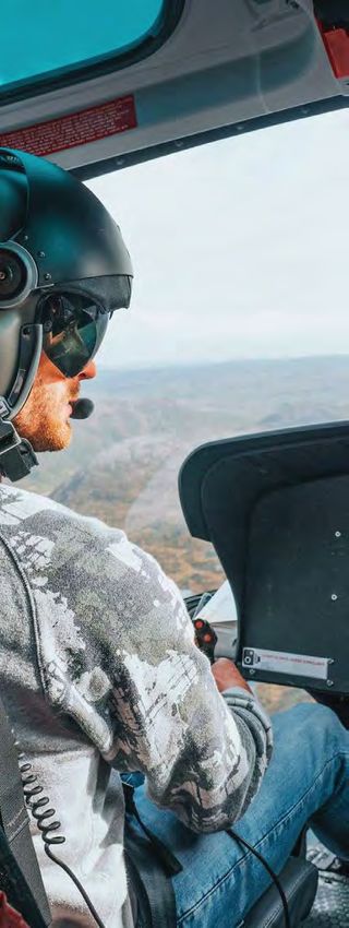
Table of Contents
Introduction..................................................................................... 3

Why Inspect Solar Systems with Manned Aircraft ..................... 3

Where to Find Aircraft & Operators.............................................. 3

Before Your Flight........................................................................... 4
      Airspace Research

      Flight Pattern Planning

      Minimum Altitudes

      Swarms & Manned Aircraft

      Land & Asset Owner Permission

      Plane of Array Irradiance

Helicopters ..................................................................................... 6
      Helicopter Models

Fixed-Wing Aircraft ........................................................................ 8
      Fixed Wing Models

Equipment Considerations............................................................ 9
      Guidance Systems

      Strafing

      Gimbals

Handheld Cameras....................................................................... 11
      Handheld Camera Models

Aircraft-Mounted Cameras ......................................................... 12
      Historical Use of MWIR

      Compraison to Drone Sensors

      Considerations for Uncooled

      Aircraft-Mounted Camera Models

Camera Setup ............................................................................... 14
      Internal vs. External Attachment

      Mounting in Fixed-Wing Aircraft

      Need for Professional-Grade Tripod

      Imaging through Windows & Glass

      Power Sources

Terminology................................................................................... 17

RaptorMaps.com                                            Guide to Solar PV Inspection via Manned Aircraft ©2021   2
Introduction
This document is a technical guide for solar PV system
inspection via manned aircraft. Inspection guidance for
unmanned aerial systems (i.e., drones) is available here.
Inspection contract specifications for PV system owners
and operators are also available here.

Why Inspect Solar Systems
with Manned Aircraft                                                                    Raptor Maps Banner on manned aircraft after a
                                                                                                    successful mission.

Manned aircraft can serve as a viable option for inspecting solar
PV systems under certain circumstances. Mobilization costs may
be minimized using manned aircraft when inspecting solar farms in
close proximity of each other. Large solar farms, where drone pilots
are unable to maintain visual line of site (VLOS) of their drone, are
a suitable use-case for manned aircraft. They are good when solar
systems are located in areas where airspace restrictions prohibit
drone operations. Certain environmental conditions such as high
winds or high temperatures can also necessitate the use of
manned aircraft as they are more equipped than drones to handle
                                                                                         Example of solar array mounted on dual-axis
environmental extremes.
                                                                                            trackers shown in greyscale infrared.
Fixed or single-axis ground mount and roof mounted solar arrays are
ideal for manned aircraft solar inspection. This is largely due to the
consistent angle at which an entire solar array is oriented, making it easy to adjust the gimbal pitch to avoid glare.

     Conversely, manned aircraft solar inspections are not compatible with solar arrays mounted on dual-axis trackers.
Dual axis trackers are able to rotate to better track the sun throughout the day on its X-axis (East to West) as well as on
it’s Y-axis (North to South). The variation of tracker angles when inspecting this type of array make it difficult to identify
whether elevated heat signatures are caused by electrical defects or increased glare.

Where to Find Aircrafts & Operators
It’s common practice for manned aircraft solutions providers in the solar industry to use rented aircraft and contract
pilots. Charter or inspection companies are a great way to find pilots and aircraft. Certified flight instructors (CFIs) at
flight schools are also good resources. CFIs are already experienced in the aircraft and flight schools have posted rates
for students and others who have “soloed” and are eligible to rent the aircraft. Charter companies, inspection companies
and flight schools are located nationwide, so it’s only necessary to move people (such as the data capture specialist) and
equipment (such as the FLIR camera). A directory of flight schools can be found on the FAA website.

RaptorMaps.com                           Guide to Solar PV Inspection via Manned Aircraft ©2021                                         3
Flight schools can also provide connections through flying clubs where members pool resources to share one or more
aircraft.  As solar PV system inspection is a commercial activity, ensure that the pilot holds a commercial certificate
under FAA FAR Part 61.  A directory of flying clubs can be found on the AOPA website.  When renting an aircraft, ensure
that you are asking for the “wet” rate, which includes all operating costs, including fuel. Aircraft rentals may require a
minimum rental of 4-8 hours.

Before Your Flight
Airspace Research
Prior to adding a PV system waypoint, the airspace should have been thoroughly researched by the vendor or the
vendor’s pilot. This includes identifying military airspace, restricted airspace, special use airspace and controlled
airspace checks and authorizations. On the day of the inspection, temporary flight restrictions (TFRs) must be checked
again.

The pilot must also account for terrain considerations and weather. The data collection specialist is responsible for
coordinating with the customer to ensure that the PV system is fully energized and is free from soiling or other physical
obstructions that can affect the analysis.

Flight Pattern Planning
In the northern hemisphere, fixed-tilt PV systems are angled towards the south (rows run east-west), while variable tilt
PV systems (i.e., tilt tracker systems) follow the sun east to west (rows run north-south).  The ideal flight pattern is along
the rows, which means east-west passes for fixed-tilt and north-south passes for variable tilt. This is the same guidance
as drone operations or an unmodified aircraft or non-gimbaled setup, the camera is generally facing out the left or right
window, so unless it it close to solar noon, the camera will be facing the rear of the panels and usable data cannot be
collected on the return pass.

RaptorMaps.com                          Guide to Solar PV Inspection via Manned Aircraft ©2021                                   4

Minimum Altitudes
Above ground level or AGL refers to an aircraft’s altitude relative to the ground below. Mean Sea level or MSL refers to
an aircraft’s altitude above the average sea level, which makes it a constant value no matter what kind of terrain is below.
Drones and manned aircraft that are operating at low heights or landing will use AGL.

   For solar farm inspections, it is recommended to communicate altitude to the pilot in both AGL and MSL so you
know exactly how high over the solar farm you are flying, which is a critical element of capturing good data.

Manned aircraft altimeters work off of pressure altitude which corrects for atmospheric conditions to maintain a given
altitude. Small aircraft do not have radar altimeters that tell them how high they are above the ground. Because of this,
the best way to ensure that the pilot flies at the correct altitude for each site is to:

  1. Find the elevation of the site above sea level (Google Earth works well for this).

  2. Add the inspection altitude required (AGL) to the site elevation above.

  3. The resulting altitude is in MSL. Provide the pilot with this altitude to fly, which will be accurate as long as the pilot
     has the correct pressure setting for the area in the altimeter.

    A manned, fixed-wing aircraft must maintain an altitude of at least 500 feet above ground level (AGL) when
performing maneuvers (such as performing turns). Higher altitudes allow for a greater margin of safety. Below 500 feet
AGL, an aerobatics license is required.

Swarms & Manned Aircraft
    While it is common to “swarm” drones, with up to four operating
simultaneously, this is not recommended for manned aircraft due to safety
concerns. Multiple manned aircraft should not be used simultaneously for
solar inspections.

Land & Asset Owner Permission
Manned aircraft do not require landowner or asset owner permission
to collect thermal or color imagery. Some vendors even choose to gather
intelligence on competitor solar systems, with the goals of increasing
sales and providing customers with data and intelligence.

Plane of Array Irradiance
The plane of array (POA) irradiance from on-site sensors should be
used the ground truth to confirm minimum irradiance levels during aerial
inspection.  Intermittent clouds may require a change in the flight plan
because it’s not economical or environmentally-friendly for an aircraft to
remain in a holding pattern. For overview level inspections, failure to verify
irradiance means that a majority or all of the data may have been captured                        Raptor Maps’ mobile app displays real-time
                                                                                                   plane-of-array irradiance fused with their
under substandard conditions.                                                                                  solar data model.

RaptorMaps.com                           Guide to Solar PV Inspection via Manned Aircraft ©2021                                            5
Helicopters
A manned (piloted) helicopter is an acceptable choice for inspection. Although utilities are increasingly utilizing UAS
for transmission line inspections, helicopters have traditionally been the the backbone of the fleet.  Helicopters may
be operated in doors-open or doors-off configurations, which is great as infrared waves cannot travel through window
glass. With a helicopter, it is possible to hover and descend over a PV system to obtain high quality, high resolution
sample data. However, when dozens of PV systems are scheduled in a single day, quality can degrade. Ensure that
your vendor contract requires original data to prevent degradation in quality at scale.

    High winds need to be considered when conducting manned operations While helicopters have omnidirectional flight
capabilities, slower and controlled flight (including hovers) with a significant tailwind (above 15 knots) add additional risk
factors. These include loss of tail rotor effectiveness, yaw stability, longitudinal stability issues due to wind getting under
(or over) large stabilizer surfaces and potential compressor stall issues in turbine machines.

   In high tailwinds the helicopter vertical tail (and fuselage) may align try to align with the wind, resulting in
uncommanded yaw. If not corrected with proper pedal input, this may lead to loss of control. Clear communication
between the pilot and camera operator is recommended to deconflict any wind-induced data capturing blockers.

   Safety during helicopter operations is also paramount. Any equipment present within the helicopter cabin during a
doors-open or doors-off flight must be secured and/or be fastened to a stable mount to minimize the risk of loss of items
and flying debris. Loose items pose safety and equipment damage risk and items caught in the tail rotor can require
emergency landing.

RaptorMaps.com                          Guide to Solar PV Inspection via Manned Aircraft ©2021                                6
Helicopter Models
                                          Example helicopters that can be used for solar PV site
                                          inspections (a partial list) include:

                                          Robinson R44
                                          The most common helicopter for solar system inspection
                                          is the Robinson R44, the world’s best-selling helicopter. It
                                          has a range of 300 nautical miles and seats four, so there
                                          is adequate room for a pilot and data capture specialist.
                                          Operating costs to contract with an R44 pilot and aircraft can
                                          be $500–900 per hour.  Weight Limit Per Seat - 300lb.

                                          Robinson R22
                                          When an overview-level inspection is needed for fewer than
                                          five small C&I PV systems, the Robinson R22 is a good
                                          choice. It is a smaller, two seat variant of the R44, and has
                                          a range of 200 nautical miles. In this configuration, a data
                                          capture specialist uses a handheld camera setup, such as the
                                          FLIR T1020 and Fluke TiX580. Operating costs to contract
                                          with an R22 pilot and aircraft can be $300–700 per hour.  The
                                          R22 is not recommended for large portfolios and large solar
                                          systems. Weight Limit Per Seat - 240lb.

                                          Bell 206 - JetRanger
                                          If there are no Robinson R44s near the solar site, the Bell 206
                                          JetRanger is a good option. The price point is typically more
                                          expensive at $1200-$1500 per hour, however when factoring
                                          in mobilization fees for a wvdistant R44, the JetRanger can
                                          become economically viable. Weight Limit Per Seat - None.

RaptorMaps.com   Guide to Solar PV Inspection via Manned Aircraft ©2021                                 7
Fixed-Wing Aircraft
Fixed-Wing Aircraft Models
Example fixed-wing aircraft that can be used for solar PV site inspections (a partial list) include:

Cessna 172 Skyhawk
The Cessna 172 Skyhawk is the most common aircraft in the world. Most pilots have trained on this easy-to-operate,
four-seater aircraft. The high-wing design of the 172 means that operators sit underneath the wing and have a superior
view. For a data capture specialist, this means that a camera pointed downwards from within the cabin will have a
relatively clear field of view. The two main obstructions to the field of view in a 172 are the wing spar (diagonal support)
and the non-retractable wheel.

Cessna 182 Skylane
The Cessna 182 Skylane is a larger, faster variant of the 172. The increased cabin area means that interior modification
of the aircraft is not necessary, and the data capture specialist can be more comfortable. The 182 is also more likely to
have upgraded cockpit instrumentation, resulting in a better flying experience.

RaptorMaps.com                          Guide to Solar PV Inspection via Manned Aircraft ©2021                                 8
Equipment Considerations
Guidance Systems
For solar PV system inspection, two types of guidance systems
are necessary for manned aircraft. The first is a general aviation
app, such as ForeFlight Mobile or Garmin Pilot. In addition to
guiding the aircraft to the correct PV system, the apps provide
critical information to pilots such as weather, airport-specific
information and communication frequencies.

     The app may not ingest latitude and longitude data required
to pinpoint the PV system. Five decimal places are needed e.g.,
(42.35930, -71.09356), but this may be truncated by the guidance
app. In areas with a high density of PV systems, pilots cannot solely
rely on ForeFlight or Garmin, as the risk of inspecting the wrong PV
system is high.

The second type of guidance system ensures that data has
been captured for the entire PV system and there are no gaps
in coverage. This can be accomplished with commercially-
available control systems such as those used for crop dusting,
skywriting and search-and-rescue. Vendors may also develop
mobile applications that incorporate telemetry data from the
aircraft, imaging system and/or tablet computer to both illustrate
coverage and direct pilots.

Strafing
Strafing is the ability to move the camera independent of the
aircraft in order to capture multiple sweeps without performing
multiple aerial passes.

    When strafing, each camera pass will result in a more
“extreme” angle, and the relative distance from the modules to
the aircraft will increase, resulting in a lower resolution. If strafing                   Raptor Maps coverage application for manned
occurs near solar noon on a tilt tracker system, the camera angle                           aircraft. Green boxes indicate coverage, blue
                                                                                          arrow indicates aircraft direction, orange chevron
can exceed the manufacturer-recommended angle of incidence
                                                                                                           indicates north.
on rows that are farther away. For fixed-tilt PV systems or tilt
tracker systems operating in the early morning or late afternoon,
ensure that the rows being strafed are not obscured by rows
closer to the aircraft.

RaptorMaps.com                             Guide to Solar PV Inspection via Manned Aircraft ©2021                                              9
Drone-mounted gimbal.

Gimbals
With fixed-wing inspections, strafing is accomplished by use of a gimbal. A gimbal system requires tight integration with
aircraft positional sensors to ensure that it is pointed at the correct target at all times. Nearly all drones have gimbaled
sensors as this data is already being processed onboard in order for a drone to function.

A gimbal that maintains a fixed field of view regardless is not strafing. In order to strafe, a gimbal must be programmed
with the appropriate pattern to capture to the area of interest. For utility-scale systems, metadata from the gimbal must
be associated with each radiometric image in order to ensure accurate coverage and facilitate analysis.

With helicopter inspections, strafing can be accomplished by manual effort from the data collection specialist. If the
imaging system is mounted to a tripod, the human can pan the camera back and forth to strafe the area of interest.

      Wing-mounted gimbal on Cessna. Source: soloy.com                  Example of a helicopter with nose-mounted camera gimbal.
                                                                                           Source: orbicair.com

RaptorMaps.com                          Guide to Solar PV Inspection via Manned Aircraft ©2021                                     10
Handheld Cameras
Handheld cameras are not recommended for utility-scale PV systems, as the the lack of distinctive landmarks will
result in gaps in coverage and make automated analysis difficult. Handheld cameras are also not recommended for
fixed-wing aircraft, as motion blur will occur, and the minimum required flight speed does not provide sufficient time for a
human to focus and trigger the shutter.
Handheld Camera Models
Despite drawbacks with handheld cameras, two recommended handheld thermal cameras are the FLIR T1020 and the
Fluke TiX580. Both cameras are in the long-wave infrared (LWIR) spectral range, and inspections can be done to IEC TS
62446-3:2017 compliance with a tight data capture protocol.
Specification FLIR T1020 Fluke TiX580
Spectrum 7.5–14 μm (long-wave IR) 7.5–14 μm (long-wave IR)
Lens Configuration 12° (83.4 mm lens) 4x telephoto
Radiometric Thermal Resolution 1024 × 768 640 × 480
Artificial Resolution Enhancement 1024 × 768 1280 × 960 SuperResolution
Helicopter Max Altitude for IEC 145 m (476 ft) 129 m (423 ft)
Compliance
Configuration for a FLIR T1020 to achieve Configuration for a Fluke TiX580 to achieve IEC-compliant 3.0 cm per pixel.
IEC-compliant 3.0 cm/pixel. Source: flir.com Source: fluke.com
RaptorMaps.com Guide to Solar PV Inspection via Manned Aircraft ©2021 11Aircraft-Mounted Cameras
Historical Use of MWIR
Mid-wave infrared (MWIR) thermal cameras have historically
been utilized for manned aircraft inspections of solar PV
systems. Defects can be visualized, however these thermal
cameras are not IEC compliant. Per the IEC, “Cameras
operating in wavelength range of 2 µm to 5 µm shall only
be used for thermography of electrical BOS components,
e.g. fuses. Due to the transparency of glass in the range
of 3 µm the use of that range on PV modules can lead to
measurement errors.” As seen in the table below, the most
popular models for PV system inspection fall within this
spectral range.
Comparison to Drone Cameras
MWIR thermal cameras have historically been used due to
low integration times. By relaxing the standards on the type
of light that can enter the camera, more light can be collected
in a shorter amount of time, which prevents the image from
blurring. Manned fixed-wing aircraft are required to maintain
significant margin above the stall speed — the speed at
which there is significant loss of lift. In contrast, drone-
based cameras have a 46% longer integration time, but fly
much slower over the PV system. Integration times that are
too short relative to the amount of light suffer from image
degradation (e.g., a grainy photograph taken at night).
Considerations for Uncooled Cameras
In order to achieve these lower integration times, the MWIR
sensors must be cooled, which contributes to the size, weight
and power (SWaP) needed, resulting in a larger camera
system. Although increased sensitivity can be an advantage
of a cooled system, there are several reasons why uncooled
thermal cameras can be advantageous:
• Far distance to target. A drone is extremely close to the
PV module target, while a manned aircraft is much farther
away. The distortion due to the atmosphere outweighs the
benefits of cryocooling. Cryocooling is advantageous for
tightly controlled benchtop scenarios (e.g., thermal imaging
of microchips).
RaptorMaps.com Guide to Solar PV Inspection via Manned Aircraft ©2021 12• Lack of correction factors. Aerial thermography using manned aircraft does not typically make use of instantaneous,
on-site plane of array (POA) measurements or correct for ambient temperature and humidity. The sensitivity to these
correction factors is several orders of magnitude higher than the effect of cooled vs. uncooled sensors.
• Exceeds warranty requirements by 3 orders of magnitude. The stated sensitivity of the most popular drone-based
LWIR cameras is ≤50 mK, while the cooled MWIR sensor sensitivities are ≤30 mK and ≤45 mK, respectively. This is a
difference 0.005 °C, which is negligible when compared to typical module manufacturer warranty thresholds of 20-40
°C temperature delta, depending on the defect modality.
Aircraft-Mounted Camera Models
FLIR, one of the large thermal imaging companies, recently released a new line of Strained Layer Superlattice (SLS)
cameras. The SLS cameras combine long-wave infrared (LWIR) imaging, one of the requirements for IEC-compliant
inspections, with long lenses (50–200 mm focal length), which enables sensors to be farther away from solar PV
modules (i.e., a safe altitude for aircraft). It’s recommended that customers require access to the original data, including
metadata, to verify the data capture setup used.
Common camera sensors for manned aircraft are summarized in the table below. Other sensors may be acceptable but
must meet resolution, metadata and image type requirements including radiometric thermal images.
Common Thermal Camera Sensors
A6780 MWIR A8580 MWIR A6780 SLS (LWIR) A8580 SLS (LWIR)
IEC-Compliant No No Yes Yes
Recommended Variant A6783 A8583 A6783 A8581
Sensor Resolution 640 × 512 1280 × 1024 640 × 512 1280 × 1024
Recommended Lens 100 mm, 200 mm 100 mm, 200 mm 50 mm, 100 mm, 50 mm, 100 mm,
Options 200 mm 200 mm
Spectral Response ≤20 mK ≤30 mK ≤45 mK ≤45 mK
Integration Time 0.48–8.00 ms 0.48–22.73 ms 0.48–22.73 ms 0.48–22.73 ms
Cooling Closed-cycle rotary Linear Sterling Closed-cycle rotary Linear Sterling
cooler
Comparing the A6000 & A8000 Series
The A6000 series has a resolution of 640 × 512, which is equivalent to most thermal imaging systems in drones.
However, because manned aircraft are necessarily 5–20 times farther away from solar sites than drones, an “equivalent”
resolution on a manned aircraft is less useful in practice. This economical imaging system is only recommended for
helicopter-based C&I inspections and utility-scale overview inspections to detect offline strings and larger issues.
RaptorMaps.com Guide to Solar PV Inspection via Manned Aircraft ©2021 13The A8000 series has a resolution of 1280 × 1024 and is
the preferred thermal imaging system. The field of view is twice
as wide as the A6000 series for an equivalent focal length,
requiring fewer passes to capture a complete dataset.
The longest focal length lens available for these cameras is
200 mm. The 200 mm lens enables an aircraft to be maximally
distant from the target, but the shorter integration time
and wider field of view afforded by a 100 mm lens may be
preferable to the user. Both are supported but the 100 mm
lens is recommended as it offers a good balance between safe
distance from the target and easy communication of coverage
and flight plan between pilot and data collection specialist.
Longer focal length results in a zoomed in image and
narrows the field of view. This is a necessary tradeoff for
manned aircraft, as the sensor (camera on the airplane) is
500–2,000 feet away from the target (PV module). A 50 mm is
acceptable for helicopter-based C&I inspections and overview
inspections but will necessitate closer proximity to the site
which may be distracting for individuals on the ground.
Camera Setup
External vs. Internal Attachment
Any external attachment of a camera is considered a PV system visibility underneath a high-wing, such
modification or alteration of the aircraft and must be reviewed as the Cessna 172 and 182.
by an airframe and/or powerplant (A&P) mechanic. If the
weight, balance, structural strength, performance, power plant
operation or flight characteristics are unaffected, the A&P mechanic can sign off on the logbook.
The camera setups used for manned aircraft inspection of solar PV systems are bulky and heavy when compared to
small action-cameras (e.g., GoPro). These modifications require FAA approval via FAA form 337 “Major Repair and
Alteration.” For this reason, temporary setups, such as internal mounting are most commonly used. Although vendors
that own and operate their own aircraft often improve the mounting system and file form 337.
RaptorMaps.com Guide to Solar PV Inspection via Manned Aircraft ©2021 14FLIR infrared camera mounted to tripod in cabin. Must be secured by multiple ratchet straps of equivalent. Mounting in Fixed-Wing Aircraft Cessna 172 Skyhawk In a Cessna 172, the camera should be pointed downward, out the window, and angled between the wing spar and the wheel. The camera should be vertical (nadir) as possible. The angle of the camera relative to nadir should be carefully measured. This can be accomplished by placing a pattern of known size in the center of the field of view, and measuring the distance to the midline of the aircraft. Other methods, such as utilization of an inclinometer, are also acceptable. Cessna 182 Skylane Considerations In a Cessna 182, the front right seat does not require removal. It can instead be slid up to accommodate the camera. Need for Professional-Grade Tripod A mounted camera can weigh up to five pounds. It will attach to a standard tripod shoe with 1/4-20 threads, but a sturdy, professional-grade tripod must be used. The camera is heavier than a typical SLR camera and the aircraft maneuvering will generate forces in all directions. RaptorMaps.com Guide to Solar PV Inspection via Manned Aircraft ©2021 15
Open window on Cessna 172 with thermal camera pointing downward.

Imaging Through Windows & Glass
LWIR and MWIR frequencies cannot penetrate windows in aircraft. So windows must be open for proper PV system
imaging. It is at the discretion of the pilot and data capture specialist whether to open the window at each PV system or
leave the window open for the duration of the flight. This is not an issue for externally-mounted gimbals, which have a
Germanium lens cover that is transparent to LWIR and MWIR. Owners of manned aircraft may consider installing a port
through the bottom of the aircraft which could be opened for PV system inspections.

Power Sources
Most cameras have an inverter block, which converts AC current from a wall outlet to DC current. Aircraft batteries
and external batteries that can power your setup are already DC. However, it is not recommended to bypass the AC/
DC inverter and directly connect DC current from a battery to your imaging setup. The equipment is sensitive to small
fluctuations in voltage, and “clean” power is required. The efficiency gains from eliminating two conversions (DC to AC,
and AC back to DC) do not outweigh the risk to the equipment. It is recommended instead that you carry extra battery
capacity.

    Ensure that you are following FAA guidelines with regards to battery power. Some vendors have unfortunately tried
using lead acid car and marine batteries in the cockpit to power imaging setups.
The preferred alternative, if you own or lease the aircraft, is to power your setup directly from the aircraft. Make sure you
are utilizing a qualified aviation electrician.

RaptorMaps.com                          Guide to Solar PV Inspection via Manned Aircraft ©2021                             16
Terminology • Manned aircraft are those operated by an onboard, human pilot. Airplanes and helicopters are examples, but this designation also includes gliders and balloons. Inclusive terminology, such as “piloted” has not seen widespread adoption in the industry. This term can also be confusing as UAS are also piloted. Therefore, we adhere to the term “manned aircraft” in this document. • Fixed-wing aircraft are propeller or jet-driven and have wings. • Rotary aircraft are lifted by rotating blades. In this document, we use rotary aircraft and helicopter interchangeably. • Unmanned aerial systems (UAS) refers to the entire system of an aircraft (or multiple aircraft), onboard flight controllers, the ground station to send commands and operators. The terms sUAS is used to designate “small” UAS, under 55 lb. • Drone is the common term for unmanned aerial systems (UAS). In this document, we adhere to the term drone. • CFIs are Certified flight instructors. • Data collection specialist refers to the non-pilot member of the crew. he data collection specialist is responsible for ensuring a complete dataset captured according to the correct specifications. • Camera setup describes the thermal imaging system, mounting system, power distribution, camera control system and data storage. • Sensor specifically refers to the thermal camera detector, excluding the optical elements (e.g., lenses) and other parts of the camera. • Infrared is the portion of the spectrum with a wavelength beyond red. Mid-wave infrared (MWIR) is 3–8 μm wavelength, while long-wave infrared (LWIR) 8–15 μm, also known as the “thermal imaging” region. • Thermal is used interchangeably with infrared. • Radiometric is used to distinguish the physical properties of the thermal detector, as opposed to post-processing enhancements. • Strafing is the ability to move a camera independent of an aircraft. • Above ground level (AGL) refers to an aircraft’s altitude relative to the ground directly below. • Mean Sea level (MSL) refers to an aircraft’s altitude above the average sea level, which makes it a constant value. RaptorMaps.com Guide to Solar PV Inspection via Manned Aircraft ©2021 17
About Raptor Maps
Raptor Maps offers an advanced software platform to
standardize data, analyze insights and collaborate across
solar. Commissioning info, serial number mapping,
equipment records, inspections, aerial thermography,
warranty claims, mobile tools and more — all powered
by our industry-leading data model. Intelligence for the
entire solar industry — asset owners, managers, O&M,
engineers, EPCs, financiers and OEMs. Standardize and
compare data across installations, increase performance
and reduce costs. For more visit RaptorMaps.com.

RaptorMaps.com                        Guide to Solar PV Inspection via Manned Aircraft ©2021   18
You can also read