Connecting Marine Protected Areas Can Improve Ocean Health
←
→
Page content transcription
If your browser does not render page correctly, please read the page content below

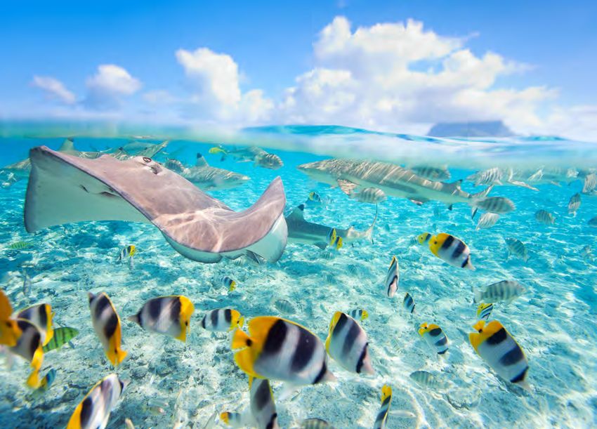
A brief from the Pew Bertarelli Ocean Legacy Project                                                                   June 2022

                                                                                                              Ron Watkins/Ocean Image Bank

Connecting Marine Protected Areas
Can Improve Ocean Health
By linking their MPAs, regions could build climate resilience, reverse biodiversity loss,
and support communities

      Overview
      The ocean plays an essential role in sustaining life on our planet. Covering nearly three-fourths of the globe,
      it is home to nearly a quarter of the world’s known species and many more yet to be discovered. It is a source
      of livelihood for coastal communities and Indigenous peoples, who have successfully conserved the sea’s
      biodiversity for millennia, using knowledge passed down through generations. And it provides billions of dollars
      in economic benefits to countless stakeholders. But harmful human activities and a changing climate are
      increasingly threatening the ocean’s health.

      Research shows that large, fully protected marine areas help conserve valuable biodiversity and can reverse many
      of the detrimental impacts caused by humans. Marine protected areas (MPAs) can also improve fish populations,
      provide ecological benefits to neighboring ecosystems, safeguard predators, maintain ecosystem stability, and
      help preserve cultures with close ties to the sea. Over the past decade, many countries have created large-scale,
      fully protected MPAs.

      These efforts are having a positive impact, yet marine biodiversity continues to decline at an unprecedented rate.1
      Therefore, conservationists—together with local communities, Indigenous peoples, scientists, and government
      officials—are looking for innovative ways to improve upon MPAs’ success by finding ways to connect and further
      protect these areas while offering marine life safe passage among them.

      In 2017, The Pew Charitable Trusts and Dona Bertarelli created the Pew Bertarelli Ocean Legacy Project, with the
      shared goal of supporting the creation of the first generation of ecologically significant, large, and effective MPAs
      around the world. Today, building on those efforts, the project also seeks to connect MPAs and help conserve key
      migratory species and entire marine ecosystems.
Accelerating the advancement of science-based
marine conservation
With ocean health declining faster than at any time in human history, there is an urgent need for action. The
evidence suggests that to halt this downward slide, more of the world’s ocean must be protected.2 Currently,
less than 8% of the global ocean is protected by an MPA—and less than half that total is safeguarded by a highly
or fully protected MPA, the level of protection that can help replenish biodiversity, build resilience against the
effects of a changing climate, secure long-term economic growth for local economies, and safeguard cultural and
traditional practices in coastal and island communities.3 A growing number of Indigenous peoples and community
champions, nongovernmental organizations (NGOs), and government leaders have called for highly protecting at
least 30% of the ocean by 2030—a target that many scientists say humanity must hit to secure our planet’s long-
term health.4

Since June 2021, governments around the globe have created a promising wave of progress on new large-scale
marine protection commitments and designations covering more than 3.4 million square kilometers (1.3 million
square miles) across some of the world’s most biologically significant waters. These include Australia’s Cocos
(Keeling) and Christmas Islands, French Polynesia, the French Southern and Antarctic Lands, and Tristan da
Cunha. Additionally, Ecuador, Costa Rica, and Panama each announced significant marine protection expansions
for the Galápagos Islands, Cocos Island, and Cordillera de Coiba, respectively.

In November 2021, Colombia, Costa Rica, Ecuador, and Panama jointly pledged to expand and connect their
respective protected territorial waters. This multilateral biosphere reserve would cover more than 500,000 square
kilometers (193,000 square miles) across some of the world’s most important migratory routes for whales, sea
turtles, sharks, and rays.

This promising regional approach would connect a constellation of MPAs of assorted sizes and levels of protection
through “biological corridors.” Like MPAs themselves, these corridors shield migratory species from human harm
and are underpinned by regional collaboration and good governance, equitable management, sustainable long-
term financing, and effective monitoring and enforcement. Networks of regional MPAs interact with one another
both ecologically and socially over huge areas and account for variables such as changing climatic conditions,
economic and cultural needs, and emerging technological and financial innovations.

This approach is rooted in the reality that ocean species, human activities, and chemical and physical
oceanography transcend national marine boundaries. Highly migratory species travel thousands of miles to
breed and feed, international fishing fleets encircle newly designated MPAs, and regulatory bodies with different
sectoral mandates operate in the same geographical space. All of this activity shows that the ocean is a complex
latticework of biological and human interactions that requires a holistic regional approach to marine conservation.
Although scientific consensus points to connected networks of marine protected areas as a best practice, research
shows that the approach isn’t followed on a consistent basis.

Over the next five years, the Pew Bertarelli Ocean Legacy Project expects to play a key role in developing and
supporting this regional approach to marine conservation in the Pacific, the Mediterranean, and the Southern
Ocean and subantarctic islands. This brief highlights some of the current and previous efforts that the project and
its partners have supported.

  2
Large-Scale Marine Protection Designations Supported
by the Pew Bertarelli Ocean Legacy Project and Its Partners
The areas have collectively added more than 10 million square kilometers
of fully or highly protected waters
                                                                    * Area fully/highly protected
  Site (Globally ranked among fully/highly                                                            Year(s)
  protected MPAs, by size)                                                                           designated
                                                                 square kilometers    square miles

  1. Ross Sea Region Marine Protected Area                           1,600,000           618,000        2016

  2. Papahānaumokuākea Marine National Monument (U.S.)               1,500,000           579,000     2006/2016

  3. Pacific Remote Islands Marine National Monument (U.S.)          1,300,000           502,000     2009/2014

  4. Pitcairn Islands Marine Reserve (UKOT)                          830,000             320,000        2016

  5. Christmas Island and Cocos (Keeling) Islands Marine Parks
                                                                     740,000             286,000       2022
  (Australia)

  6. Rapa Nui Marine Protected Area (Chile)                          720,000             278,000        2018

  7. Tristan da Cunha Marine Protection Zone (UKOT)                  690,000             266,000        2021

  8. British Indian Ocean Territory Marine Protected Area
                                                                     640,000             247,000       2010
  (UKOT)

  9. Palau National Marine Sanctuary                                 500,000             193,000        2015

  10. Ascension Island Marine Protected Area (UKOT)                  440,000             170,000        2019

  12. French Southern and Antarctic Lands (France)                   380,000             147,000       2022

  14. South Georgia and the South Sandwich Islands (UKOT)            280,000             108,000        2019

  15. Coral Sea Marine Park (Australia)                              240,000             93,000         2012

  17. Revillagigedo Archipelago National Park (Mexico)                150,000            58,000         2017

  26. Marianas Trench Marine National Monument (U.S.)                 40,000              15,000       2009

  29. Galápagos Marine Reserve expansion (Ecuador)                    30,000              11,600        2021

  30. Natural Park of the Coral Sea—Remote Reefs
                                                                      30,000              11,600        2018
  (New Caledonia)

  Total                                                              10,110,000         3,903,200

UKOT: United Kingdom overseas territory
* As defined by the International Union for Conservation of Nature
Sources: World Database on Protected Areas; MPAtlas

                                                                                                                  3
Pew Bertarelli Ocean Legacy Project
    Working to protect our ocean for our future

                                           6                                              17
                               5                                               Atlantic
                                                                               Ocean
                                                     12              13
                          4
             1                       7
                                                Pacific Ocean                             18
                                                                     14
                                   9                15      16
         Indian Ocean 2        8               11                                         19
            3
                                     10
                          21                                 23           25     20
                                         22      Southern
                                                  Ocean
                                                                24

                 Designated marine             Proposed marine                 Regional
                 protected area                protected area                  engagements

    Indian Ocean                                     13. Eastern Tropical Pacific
    1.     British Indian Ocean Territory MPA        14 Galápagos Islands
    2. Christmas and Cocos                           15 Pitcairn Islands Marine Reserve
       (Keeling) Islands                             16. Rapa Nui Marine Protected Area
    3. French Southern and                               and Motu Motiro Hiva Marine Park
       Antarctic Lands
                                                     Atlantic Ocean
    Pacific Ocean                                    17. Mediterranean Sea
    4. Palau National Marine Sanctuary               18. Ascension Island MPA
    5. Marianas Trench Marine                        19. Tristan da Cunha Marine
       National Monument                                 Protection Zone
    6. Papahānaumokuākea Marine                      20. South Georgia and the South
       National Monument                                 Sandwich Islands
    7.     Pacific Remote Islands Marine
           National Monument
                                                     Southern Ocean
    8. Coral Sea Marine Park                         21. East Antarctica
    9. Natural Park of the Coral Sea—                22. Ross Sea Region MPA
       Remote Reefs                                  23. Antarctic Peninsula
    10. Kermadec/Rangitāhua                          24. Weddell Sea
        Ocean Sanctuary
                                                     25. South Orkney Islands Southern
    11. French Polynesia                                 Shelf MPA
    12. Revillagigedo Archipelago
        National Park
    Sources: World Database on Protected Areas; MPAtlas
    © 2022 The Pew Charitable Trusts

4
Brian Gratwicke/Flickr Creative Commons

Subantarctic fur seals are among the wide range of marine life that relies on the remote, healthy, and highly protected waters surrounding
Tristan da Cunha.

Locally driven, science-based efforts result in ambitious
marine conservation
In 2021, Tristan da Cunha finalized legal designation of the largest fully protected marine reserve in the Atlantic and
the fourth largest on the planet. This ambitious action was driven by the community and reflects the community’s
long-term dedication to creating thoughtful, science-based protections that maintain ocean health while enhancing
the marine ecosystem’s resilience to climate change and respecting the island’s economic reliance on this vital
resource. This historic move also furthered the United Kingdom’s commitment to create a 4 million-square-
kilometer (1.5 million-square-mile) “blue belt” around its overseas territories.

    he marine protection zone was an important step for our community because
   T
   we are a people who have always lived in harmony with the sea. In Tristanian
   waters, you’ll find a breeding ground for blue sharks, migration routes for tuna,
   precious cold-water corals, and the Tristan rock lobster that is the mainstay of
   our economy. This is a precious place, and we want it to stay that way. I am also
   extremely proud that we can think of ourselves as being the guardians of the
   South Atlantic.”
   James Glass, Tristan da Cunha’s chief islander

                                                                                                                                                  5
Tristan da Cunha Marine Protection Zone
Fully protects over 687,000 square kilometers in the South Atlantic Ocean

                                  Tristan da
                                    Cunha

                                                           Crawford

                                                                                       Yakhont        RSA

                                                             Gough
                                                             Island                     McNish

      0                     150 mi

      0           150 km

      Fully protected area (91% of         Inshore fishing zone 50 nautical miles around the Tristan northern islands and
      exclusive economic zone)              40 nautical miles around Gough (8% of EEZ)
      Seamount fishing zones                Seamount            Depth: -200 meters               Depth: -3,000 meters
      (1% of EEZ)

Note: Cargo shipping vessels must avoid a 25-nautical-mile buffer around each of the islands.
Sources: Royal Society for the Protection of Birds; NYU Spatial Data Repository; GEBCO; MarineRegions.org; Natural Earth
© 2022 The Pew Charitable Trusts

  6
The people of Tristan da Cunha—the world’s most remote inhabited island, located 2,810 kilometers
(1,750 miles) west of South Africa—have always relied heavily on local fisheries for food and income, and
they keenly understand the importance of sustained ocean health.

Comprising a population of only 260, Tristanians steward a vast and special swath of ocean. Tristan da Cunha’s
exclusive economic zone (EEZ) extends across 758,771 square kilometers (292,963 square miles)—three times
the size of the U.K. mainland—and is one of only a few largely unexploited temperate marine ecosystems in the
world, providing an important baseline for marine habitat research.

The archipelago is also home to some of the most important seabird colonies in the world, including the critically
endangered Tristan albatross; the endangered Atlantic yellow-nosed albatross; the spectacled petrel; 85% of the
world’s endangered northern rockhopper penguins; and the smallest flightless bird in the world, the Inaccessible
Island rail, which breeds only on Inaccessible Island—one of two Tristan UNESCO World Heritage Sites.

Tristanians proudly see themselves as guardians of the South Atlantic. These protections will help enhance the
local marine environment’s resilience against the impacts of climate change and preserve Tristanians’ way of life
for generations to come. Toward that end, long-term partnerships with NGOs such as the Royal Society for the
Protection of Birds and the Pew Bertarelli Ocean Legacy Project continue to support the efforts to implement,
manage, and monitor Tristan’s waters.

                                                                                                                 Getty Images

A whale approaches the ocean surface in the Austral Islands, a remote archipelago in the South Pacific Ocean.
The French Polynesian government recently announced plans to protect these waters and their rich biodiversity.

An ancient conservation model helping restore ocean health
in the South Pacific
Rāhui, a traditional Polynesian conservation practice, continues to regain widespread use in French Polynesia,
where recent commitments to conserve 1 million square kilometers (386,000 square miles) are advancing. Rāhui
involves banning access to an area, or prohibiting the taking of a natural resource, to promote regeneration for
an entire community’s benefit. Historically, throughout the Polynesian triangle—the area between New Zealand,
Hawaii, and Rapa Nui—the practice played a key role in sustainable natural resource management.

                                                                                                                          7
Communities would set a rāhui, for example, in part of a lagoon, or throughout a bay or coconut grove, or even for
certain species of birds or taro, for a certain amount of time. Historically, these periods, which ranged in duration,
allowed habitats to regenerate, species to develop to optimal harvesting size, or populations to grow beyond
typical harvesting levels in anticipation of periods of scarcity or for celebratory events.

After Western Europeans arrived in Polynesia, the practice of rāhui gradually declined. Within a few years,
some islands lost up to 80% of their human population, mainly due to diseases brought from Europe. But despite
the loss of many other traditional practices, declines in communal ways of life, and less reliance on natural
resources amid increase imports, rāhui has survived as part of the local cultures and traditions.

In the 1980s, on the island of Rapa in the Austral Islands, the arrival of freezers led to the overfishing of coastal
fish, as local fishers began storing their catch for sale off the island. Local leadership responded by creating a
rāhui on the ancestral model to protect the island’s main bay. In an effort to mirror its success in restoring fish
populations, the rāhui revival has spread throughout French Polynesia, and many municipalities have gradually
re-established protection zones in their lagoons, including Teahupo‘o, Teva I Uta, and Tautira in Tahiti; Ua Huka in
the Marquesas Islands; and Tubuai in the Australs.

                                                                                                                    Shutterstock

French Polynesia’s southernmost islands, the Australs, are home to 14 species of sharks and four species of rays.

These recent rāhuis are hybrids, managed by the community while also benefiting from legal and government
protection under environmental or fishing regulations. French Polynesia’s Department of Marine and Mining
Resources has also taken up the concept to ensure the protection of certain species of fish, mollusks, and
crustaceans by regulating the minimum catch size for these species, and this legal recognition provides an
enforcement mechanism.

  8
Because rāhui is firmly rooted in Polynesian culture, most locals understand and accept the practice, which gives
it a significant advantage over other modern conservation tools, such as MPAs and maritime spatial management
plans. In fact, a recent survey showed that 90% of French Polynesia’s population wishes to establish a rāhui in
each community.

Momentum on rāhuis continues to grow. In February 2022, French Polynesian President Édouard Fritch announced
plans to create a 500,000-square-kilometer (193,000-square-mile) protection zone called Rāhui Nui, or “great
rāhui.” This announcement followed a campaign started in 2014 by elected officials from the Austral Islands and
supported by the Pew Bertarelli Ocean Legacy Project, seeking to create a large rāhui in their archipelago’s waters.

Additionally, the Pew Bertarelli Ocean Legacy Project has supported the Marquesas Islands community communes
and local people with technical assistance and financial support for science to help advance their efforts to create
a large-scale MPA, called Te Tai Nui A Hau, or “The Ocean of Peace,” as well as the local initiative to create a
coastal rāhui around the six islands.

                                                                                                             Laurent Ballesta/Andromède Oceanologie

Emperor penguins dive from an ice sheet in East Antarctica. Marine protections in the region would help the species adapt to the effects
of climate change.

Protecting Antarctica’s Southern Ocean
Located at the bottom of the globe are the remote icy waters of Antarctica’s Southern Ocean. Encompassing
10% of the global ocean, the region is considered one of the world’s last remaining wilderness areas and is home to
thousands of species found nowhere else.

The circumpolar current that surrounds Antarctica has given rise to incredibly diverse and fantastical species, including
brilliantly hued starfish and pastel octopuses, colossal squid, and fish with antifreeze proteins in their blood. There are
also the more widely known animals, such as emperor and Adélie penguins; crabeater and leopard seals; and humpback,
blue, and killer whales.

One lesser-known species carrying the weight of the ecosystem on its 2.5-inch back is Antarctic krill. These shrimplike
crustaceans form the base of the region’s delicate food web. Krill is a key prey for numerous Southern Ocean species,
including whales, seals, and penguins. And several predators, such as killer whales and leopard seals, consume species
that depend on krill as a food source—making krill a vital component in the Southern Ocean food chain.

                                                                                                                                                9
Krill also play a critical role in the Southern Ocean’s carbon cycle. According to recent research led by Emma
Cavan at Imperial College London, krill feed on carbon-filled phytoplankton at the ocean’s surface and then release
dense waste that can sink quickly to the deep sea, where it remains for decades. Krill also move between shallow
and deep areas multiple times daily to feed, which may increase the chances of waste reaching deep into the
water column. Both actions contribute to one of the largest regional ocean sinks for atmospheric carbon dioxide.

In a broader context, the Southern Ocean serves as the beating heart of the global ocean and the planet’s health.
Vital nutrients that well up from Antarctica’s deep ocean are carried far away by currents, breathing life into
coastal fisheries north of the equator. And because the remote Southern Ocean has one of the least altered
marine ecosystems on Earth, it serves as an unparalleled sanctuary for scientific research on the impacts of
climate change and industrial fishing.

However, the combined effects of concentrated fishing and climate change on krill—especially near the Antarctic
Peninsula’s coast—are making krill less available in the foraging area of species such as chinstrap and Adélie
penguins. These impacts are creating a ripple effect throughout the Antarctic food web, including historic die-offs
and range shifts among endemic marine species.

Yet there is some good news. Scientists and policymakers are working toward a new ecosystem-based
management measure that will ensure both a healthy krill population in the Southern Ocean and a sustainable
krill fishery over time. In doing so, they aim to leave enough krill in the water to ensure that predators’ needs are
protected and to spread out fishing so that it is not overly concentrated in predator feeding and breeding areas,
for example, off the coast of penguin colonies.

Additionally, marine scientists agree that establishing a network of large MPAs throughout the Southern Ocean is
essential for protecting biodiversity, including krill, and providing resilience to climate change. Networks of MPAs
also help species adapt to climate change by creating protected pathways for species migrations and range shifts,
and their relatively undisturbed waters provide a natural laboratory for studying how intact marine ecosystems
react to a warming and acidifying ocean.

The latest science tells us that to regenerate ocean life, we need to establish MPAs covering at least 30% of the
ocean by 2030. And Antarctic MPAs can contribute a significant percentage of that global target.

Preserving Antarctica’s unique biological resources is an important, and achievable, goal. In 2011, the member
governments of the Commission for the Conservation of Antarctic Marine Living Resources (CCAMLR) agreed
by consensus to create a representative network of MPAs in the Southern Ocean and adopt a framework for
establishing the network.

To date, CCAMLR has designated two MPAs: the South Orkney Islands Southern Shelf MPA, established in 2009
and covering 94,000 square kilometers (36,000 square miles) northeast of the tip of the Antarctic Peninsula; and
the Ross Sea Region MPA, established in 2016 as the world’s largest protected area and first large-scale reserve
on the high seas, protecting 2.06 million square kilometers (795,000 square miles) of ocean. And CCAMLR has
been discussing three other MPA proposals—in East Antarctica, the Weddell Sea, and the Antarctic Peninsula,
which together cover 3.8 million square kilometers (1.5 million square miles).

The Pew Bertarelli Ocean Legacy Project and its partners continue to work with CCAMLR and its member
governments to encourage adoption of ecosystem-based fisheries management for krill and further progress
toward establishing a network of large-scale MPAs around Antarctica.

 10
Southern Ocean Regions in Need of Protection
A network of MPAs will safeguard unique ecosystems

                                              0° Prime meridian                     Prince Edward Islands
   South Georgia and                                                                MPA (South Africa)
   the South Sandwich
   Islands MPA*                                               Bouvet
   (United Kingdom) Domain 2                                                                        Crozet Islands
                                                               Island                               MPA (France)

                                               Domain 4                60° S                                 Kerguelen
                                                                                Domain 5                     Islands
     South Orkney                                         Weddell Sea                                       MPA
   Islands Southern                                       MPA Proposal                                       (France)
       Shelf MPA                   Domain 3

       Antarctic
       Peninsula                                                                      Domain 6
         MPA                                               East Antarctic
       Proposal                                            MPA Proposal
           Domain 1                                                                                   Heard Island
                                                                                                      and McDonald
                                                      Antarctica                                      Islands Marine
                                                                                                       Reserve
                                                                                                       (Australia)

                         Domain 9                                                   East Antarctic
                                                                                    MPA Proposal

                        60° S        Domain 8
                                                                               Domain 7
                                       Ross Sea
                                      Region MPA

    Existing CCAMLR MPA                    MPAs within national                   Current MPA proposal
                                           territorial waters of the              or draft scenarios being
                                           Southern Ocean†                        negotiated by CCAMLR

* The United Kingdom designated the South Georgia and South Sandwich Islands MPA. These islands’ sovereignty remains
contested by Argentina.
† All domestic protected areas north of 60° S have been included.
Note: In 2011, CCAMLR members agreed by consensus to adopt Conservation Measure 91-04, a framework for creating a
network of MPAs, and identified nine planning domains for developing these protected areas.
Sources: CCAMLR; Natural Earth
© 2022 The Pew Charitable Trusts

                                                                                                                     11
Fully protecting the South Sandwich Islands would help a
globally critical ecosystem teeming with wildlife
Located about 4,000 kilometers (2,500 miles) north of Antarctica and 2,700 kilometers (almost 1,700 miles)
east of South America, South Georgia and the South Sandwich Islands host one of the world’s most significant
wildlife hot spots. Part of the Antarctic ecosystem, the rich waters surrounding these islands are full of
plankton and krill, which support one of the largest and most varied populations of seabirds and marine mammals
on Earth.
The islands, a British overseas territory, provide habitat for more than 4 million Antarctic fur seals—or over 95%
of the world’s population of these marine mammals—and more than half of the world’s southern elephant seals.
Humpback, sperm, and other species of whales are also frequently seen in the islands’ waters.
Paul Souders/Getty Images
South Georgia and the South Sandwich Islands are home to more than 100 million seabirds, including the wandering albatross, seen here.
12In addition, South Georgia has as many as 100 million seabirds, including vast numbers of penguins, albatross,
prions, and petrels. The Antarctic’s lone songbird, the South Georgia pipit, of which just 6,000 remain, can be
found only here. And Zavodovski Island in the South Sandwich Islands has more than 1 million pairs of chinstrap
penguins, the largest colony in the world.
Volcanic in origin, the islands are surrounded by nutrient-rich waters. And the South Sandwich Trench—which, at
more than 8 kilometers (5 miles), is among the deepest parts of the ocean—includes thermal vents that are yet
to be fully explored.
Recognizing the region’s biological significance, officials established an MPA covering 1.24 million square
kilometers (479,000 square miles), including 283,000 square kilometers (109,000 square miles) of fully
protected waters, in 2012. The protections were enhanced in 2013 and again in 2018, after the first independent
five-year review.
However, these vital marine habitats still face an uncertain future, largely because of climate change. Fishing
around the islands is limited and accounts for less than 5% of the local government’s annual revenue. Full
protection would shelter the marine ecosystem from harmful pressures, such as fishing, tourism, and invasive
species, and support critical scientific analysis of the changing climate’s impact on these waters as well as on the
wider Southern Ocean region that stretches to Antarctica.
To preserve this globally valuable marine ecosystem’s integrity, the Pew Bertarelli Ocean Legacy Project has
supported science examining these waters and has called for fully protecting the entire South Sandwich Islands
EEZ, totaling about 500,000 square kilometers (193,000 square miles), an area twice the size of the U.K. With
all extractive activities prohibited, such a sanctuary would protect globally important species and build the
ecosystem’s resilience in the face of climate change.
Ben Cranke/Getty Images
The cold, nutrient-rich waters of the Scotia Sea, along South Georgia Island’s southern coastline, help support the chinstrap penguin population.
13France takes an important step toward a sustainable and
healthy global ocean
The waters of the French Southern and Antarctic Lands—a group of widely scattered islands in the southern
Indian Ocean—host exceptional biodiversity, including orcas, pygmy blue whales, penguins, seals, tuna, and more
than a dozen different kinds of threatened or endangered seabirds. For example, the Crozet and Kerguelen Islands
provide refuge to the world’s largest king penguin colony and second-largest southern elephant seal colony,
respectively. And Amsterdam Island is home to the roughly 30 remaining breeding pairs of Amsterdam albatross,
a critically endangered species found nowhere else on Earth. Researchers, military personnel, and support staff
visit the islands occasionally, but the overseas territory has no long-term human inhabitants.
Bruno Marie
King penguins amass on an island in the Kerguelen archipelago, part of a remote overseas territory in the southern Indian Ocean that
France protected in 2022.
In February 2022, France announced about 1 million square kilometers (386,000 square miles) of expanded
marine protections around Saint Paul and Amsterdam Islands, the Kerguelen Islands, and the Crozet Islands. The
expansion makes the waters around the three archipelagos the largest MPA in French waters by far, representing
about 15% of the country’s global EEZ.
Most importantly, the new marine reserve also includes a new highly protected area surrounding Saint Paul and
Amsterdam Islands and covering about 255,000 square kilometers (98,500 miles), which prohibits all extractive
activities, such as industrial fishing. The expansion more than doubles the percentage of highly protected French
waters, up from 1.6% to 4%, but still leaves the country with a challenge of achieving its goal of highly protecting
at least 10% of its waters by the end of 2022. Science shows that highly protected areas provide the most
significant ecological benefits.
The Pew Bertarelli Ocean Legacy Project has been building support for highly protecting these waters since 2016,
largely through a group of leading conservation NGOs in France organized by the project.
14Conclusion
Over the past decade, and informed by the best available science, many countries have created large-scale,
highly and fully protected MPAs that prohibit harmful human activities, such as industrial fishing. These efforts
have helped to safeguard millions of square kilometers of ocean all around the globe.
Although these actions are having a positive impact, marine biodiversity continues to decline at an
unprecedented rate. Governments, Indigenous peoples, community champions, NGOs, scientists, and others
must accelerate the pace of protection and find innovative ways to improve upon MPAs’ success, including
approaches that provide safe passage among these areas for marine life.
Working together—and at a regional scale—leaders, conservationists, local residents, and others can apply
ambitious new ideas, collaborative policies, and governance to secure a healthy, biodiverse ocean that serves
both nature and people around the world.
Acknowledgments
This brief was prepared by Johnny Briggs, Ashleigh Cirilla, Andrea Kavanagh, Jérôme Petit, and Jen Sawada of
the Pew Bertarelli Ocean Legacy Project, with assistance from Matt Rand. Pew staff members Erika Compart,
Barb Cvrkel, Ned Drummond, Matthew M. Moser, Jennifer Peltak, Alissa Skelton, and Ken Willis provided editing,
design, and web support.
15Endnotes
1 B.S. Halpern et al., “Recent Pace of Change in Human Impact on the World’s Ocean,” Scientific Reports 9 (2019),
https://doi.org/10.1038/s41598-019-47201-9.
2 B.C. O’Leary et al., “Effective Coverage Targets for Ocean Protection,” Conservation Letters 9, no. 6 (2016): 398-404,
https://doi.org/10.1111/conl.12247.
3 International Union for Conservation of Nature and U.N. Environment Programme World Conservation Monitoring Centre, The World
Database on Protected Areas, 2022, accessed May 23, 2022, https://www.protectedplanet.net.
4 Convention on Biological Diversity, “First Draft of the Post-2020 Global Biodiversity Framework,” accessed May 23, 2022,
https://www.cbd.int/doc/c/abb5/591f/2e46096d3f0330b08ce87a45/wg2020-03-03-en.pdf.
For further information, please visit:
pewtrusts.org/ocean-legacy
Contact: Matt Rand, senior director, Pew Bertarelli Ocean Legacy Project
Email: mrand@pewtrusts.org
Website: pewtrusts.org/ocean-legacy
The Pew Bertarelli Ocean Legacy Project | The Pew Charitable Trusts and Dona Bertarelli created the Pew Bertarelli Ocean
Legacy Project, with the shared goal of establishing the first generation of ecologically significant, large, and effective
marine protected areas (MPAs) around the world. Today, the Pew Bertarelli Ocean Legacy Project also seeks to connect
MPAs and help conserve key migratory species and entire marine ecosystems. These efforts build on more than a decade
of work by Pew and the Bertarelli Foundation, led by Dona Bertarelli, to create large-scale, highly or fully protected MPAs.
Between them, they have helped to obtain designations or commitments to safeguard nearly 12.6 million square kilometers
(4.8 million square miles) of ocean by working with communities, local leaders, philanthropic partners, Indigenous groups,
government officials, and scientists. Dona Bertarelli is a philanthropist, investor, sportswoman, and strong advocate for
ocean conservation. The Pew Charitable Trusts is driven by the power of knowledge to solve today’s most challenging
problems, including the need for effective marine conservation.You can also read


