City of Columbia Landfill Site Master Plan - City of Columbia, Missouri Project No. 95073 Revision 1 April 2017
←
→
Page content transcription
If your browser does not render page correctly, please read the page content below
City of Columbia Landfill
         Site Master Plan

     City of Columbia, Missouri
                 Project No. 95073

                        Revision 1
                        April 2017
City of Columbia Landfill
         Site Master Plan
                       prepared for

            City of Columbia, Missouri

                   Project No. 95073

                        Revision 1
                        April 2017

                       prepared by

Burns & McDonnell Engineering Company, Inc.
                 Kansas City, Missouri

COPYRIGHT © 2017 BURNS & McDONNELL ENGINEERING COMPANY, INC.
INDEX AND CERTIFICATION
City of Columbia, Missouri
City of Columbia Landfill
Site Master Plan
Project No. 95073
Report Index
Chapter Number
Number Chapter Title of Pages
1.0 Introduction 2
2.0 Site Background & Existing Conditions 4
3.0 Need for Expansion 2
4.0 Ecological & Natural Resources Assessment 4
5.0 Clean Power Generation Potential 4
6.0 South Landfill Development Plan 9
7.0 Permitting & Schedule 1
8.0 Conclusion 2
Figures 4
Appendix A Existing Landfill Remaining Life Calculations 1
Appendix B Landfill Gas Infographic 1
Appendix C South Landfill Life of Site Calculations 2
Appendix D Project Schedule 1
Appendix E Water Treatment Infographic 1
Appendix F CATSO Major Roadway Plan 1
Appendix G Ecology Infographic 1
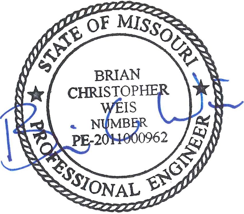
Certification
I hereby certify, as a Professional Engineer in the state of Missouri, that the information in this document
was assembled under my direct personal charge. This report is not intended or represented to be suitable
for reuse by the City of Columbia, Missouri or others without specific verification or adaptation by the
Engineer.
Brian C. Weis, P.E., Missouri, No. 2011000962
Date: 08/01/2017Landfill Site Master Plan Revision 1 Table of Contents
TABLE OF CONTENTS
Page No.
0.0 EXECUTIVE SUMMARY ....................................................................................0-1
1.0 INTRODUCTION .................................................................................................. 1-1
1.1 General ................................................................................................................. 1-1
1.2 Purpose ................................................................................................................. 1-1
1.3 Plan Organization................................................................................................. 1-2
2.0 SITE BACKGROUND & EXISTING CONDITIONS ........................................ 2-1
2.1 Existing Landfill Site ........................................................................................... 2-1
2.2 Population Served ................................................................................................ 2-2
2.3 Onsite Services and Facilities .............................................................................. 2-2
2.4 Site Characteristics............................................................................................... 2-3
2.4.1 Topography, Drainage, and Permitted Outfalls .................................... 2-3
2.4.2 Site Wastewater and Utilities ................................................................ 2-3
2.4.3 Site Access and Traffic ......................................................................... 2-4
3.0 NEED FOR EXPANSION ................................................................................... 3-1
3.1 Remaining Life of Existing Landfill .................................................................... 3-1
3.2 Expansion Alternatives ........................................................................................ 3-2
4.0 ECOLOGICAL & NATURAL RESOURCE ASSESSMENT ............................ 4-1
4.1 Project Setting ...................................................................................................... 4-1
4.2 Vegetation ............................................................................................................ 4-1
4.3 Wildlife Species ................................................................................................... 4-1
4.4 Protected Species ................................................................................................. 4-2
4.5 Cultural Resources ............................................................................................... 4-3
4.6 Streams and Wetlands .......................................................................................... 4-3
5.0 CLEAN POWER GENERATION POTENTIAL ............................................... 5-1
5.1 Overview of Landfill Gas to Energy System ....................................................... 5-1
5.2 Columbia Water & Light Renewable Energy Portfolio ....................................... 5-1
5.3 Near-Term Power Generation Capacity............................................................... 5-2
5.4 Long-Term Power Generation Scenarios............................................................. 5-3
6.0 SOUTH LANDFILL DEVELOPMENT PLAN ................................................... 6-1
6.1 Expansion Concept .............................................................................................. 6-1
6.2 Life of Site ........................................................................................................... 6-1
6.3 Topography & Drainage ...................................................................................... 6-2
6.4 Wastewater & Utilities......................................................................................... 6-3
6.5 Site Access & Transportation .............................................................................. 6-4
City of Columbia, Missouri TOC-1 Burns & McDonnellLandfill Site Master Plan Revision 1 Table of Contents
6.6 Ecological Preservation and Restoration Plan ..................................................... 6-5
6.7 Landfill Gas Utilization ....................................................................................... 6-7
6.8 Soil Balance ......................................................................................................... 6-7
6.9 Design & Operation ............................................................................................. 6-9
7.0 PERMITTING & SCHEDULE .............................................................................. 7-1
8.0 CONCLUSIONS................................................................................................... 8-1
8.1 Plan Limitations ................................................................................................... 8-2
FIGURES
– EXISTING LANDFILL REMAINING LIFE CALCULATIONS
– LANDFILL GAS INFOGRAPHIC
– SOUTH LANDFILL LIFE OF SITE CALCULATION
– PROJECT SCHEDULE
APPENDIX E – WATER TREATMENT INFOGRAPHIC
APPENDIX F – CATSO MAJOR ROADWAY PLAN
APPENDIX G – ECOLOGY INFOGRAPHIC
City of Columbia, Missouri TOC-2 Burns & McDonnellLandfill Site Master Plan Revision 1 Table of Contents
LIST OF TABLES
Page No.
Table 4-1: Missouri Natural Heritage Database for Boone County ........................................ 4-2
Table 6-1: Potential Conservation and Restoration Opportunities .......................................... 6-6
City of Columbia, Missouri TOC-3 Burns & McDonnellLandfill Site Master Plan Revision 1 Table of Contents
LIST OF FIGURES
Page No.
Figure 1-1: Site Location Map .................................................................................................... 1-1
Figure 2-1: Existing Landfill Site……………………….………………………(Figures Section)
Figure 5-1: Landfill Gas Utilization System Diagram ................................................................ 5-1
Figure 6-1: Base Grades……………………………………………...............…(Figures Section)
Figure 6-2: Final Grades…………………………………………………….…..(Figures Section)
Figure 6-3: Waco Road Expansion………………………………………...……(Figures Section)
City of Columbia, Missouri TOC-4 Burns & McDonnellLandfill Site Master Plan Revision 1 Executive Summary
0.0 EXECUTIVE SUMMARY
Burns & McDonnell was retained by the City of Columbia, Missouri to provide a Master Plan for the
City’s Landfill Site. The City’s residents and businesses enjoy the benefit of comprehensive solid waste
services provided at low costs and in a manner which prioritizes the protection of the environment and
natural resources. The 107-acre existing Landfill is estimated to reach capacity between 2026 and 2031.
The expansion of the existing landfill at the southern portion of the Site is believed to be the best apparent
alternative for the City of Columbia to continue providing solid waste services to citizens and businesses.
A new South Landfill conceptualized on the existing site is estimated to add 40 to 80 years of disposal
capacity. If the new South Landfill is constructed, opportunities exist to enhance and conserve the
biological community and natural resources cost effectively while developing the landfill over time. The
intent is to preserve, enhance, and create sufficient high value wildlife habitat in and around the
development to support the existing wildlife populations that occur in the area.
Landfill gas from the new South Landfill can be beneficially utilized for electrical power generation
beyond the life of the new facility. Utilization of landfill gas is an integral part of the City’s Renewable
Energy Portfolio; without this energy generation extending into the future, the City would be faced with
purchasing renewable energy from other renewable sources at a higher cost.
The City’s long-term transportation plan has been incorporated into the South Landfill conceptual design.
The infrastructure required for the development has been evaluated and is determined to be feasible.
Adequate soil is likely available onsite and in adjacent, City-owned parcels to support the long-term
operation of the new South Landfill.
The permitting and development of the South Landfill will require significant time and effort to plan and
design. It is recommended that for planning purposes, the City assume the first cell will need to be
constructed prior to 2026. Design and permitting tasks should begin in the fall of 2017 to enable the
construction of the first cell of the South Landfill prior to 2026.
City of Columbia, Missouri 0-1 Burns & McDonnellLandfill Site Master Plan Revision 1 Introduction
1.0 INTRODUCTION
1.1 General
The City of Columbia, Missouri (City) owns and operates a sanitary landfill in Boone County, Missouri.
The Columbia Sanitary Landfill is located in northeast Columbia, approximately 1 mile east of Route B at
5700 Peabody Road in the Northeast 1/4 of Section 22, Township 49 North, Range 12 West. The site is
bordered by Rogers Road to the east, Hinkson Creek to the north and west, and North Wyatt Lane to the
south. A location map of the Landfill site is provided below:
Figure 1-1: Site Location Map
1.2 Purpose
Burns & McDonnell was retained by the City of Columbia to provide a Master Plan for the City’s
Landfill Site. The City’s residents and businesses enjoy the benefit of comprehensive solid waste services
at low costs, provided in a manner which prioritizes the protection of the environment and natural
resources. Operating the Landfill in close proximity to the residents and businesses is a significant driver
of low costs and quality service for the City of Columbia solid waste rate payers. In order for the Solid
Waste Utility to continue this quality and cost efficient service, it is in the City’s interest to sustain the
long-term operation of the Landfill Site.
City of Columbia, Missouri 1-1 Burns & McDonnellLandfill Site Master Plan Revision 1 Introduction
The purpose of this Landfill Site Master Plan (Plan) is to demonstrate the need for an onsite Landfill
Expansion, examine the beneficial environmental features that can be incorporated into the Site
development, and conceptualize a long term development plan for the Site.
1.3 Plan Organization
This Plan is organized into the following sections:
Section 2: Site Background & Existing Conditions
Section 3: Need for Expansion
Section 4: Ecological & Natural Resource Assessment
Section 5: Clean Power Generation Potential
Section 6: South Landfill Development Plan
Section 7: Permitting & Schedule
Section 8: Conclusions
City of Columbia, Missouri 1-2 Burns & McDonnellLandfill Site Master Plan Revision 1 Site Background & Existing Conditions
2.0 SITE BACKGROUND & EXISTING CONDITIONS
The Site was previously owned by the Peabody Coal Company, which strip-mined the Site for coal until
the early 1970s. The mined coal was used to fuel trains and satisfy industrial demands including a source
of heat to enable electric power production. The City acquired the site and initially permitted the Landfill
for solid waste disposal in August 1985 (Missouri Department of Natural Resources [MDNR] Solid
Waste Permit No. 101908).
2.1 Existing Landfill Site
The Columbia Landfill property contains approximately 720 acres, which consists of 160 acres of
property west of Hinkson Creek and 560 acres of property east of Hinkson Creek.
The 160 acres of Landfill property located west of Hinkson Creek was purchased to provide a buffer for
the Landfill. The property could be used as a source for cover material (soil) in the future. It is not
anticipated that this property would be used for waste disposal.
The 560 acres of Landfill property located east of Hinkson Creek contains the current permitted area for
solid waste disposal activities and several support facilities. The current permitted solid waste disposal
area contains approximately 107 acres and is located in the northeastern portion of the property. Located
south and west of the current permitted area are several facilities that support the Landfill and the Solid
Waste Utility. South of these facilities is an undeveloped area of the property consisting of open crop
fields, ponds resulting from prior strip mining, and forested areas. The south, undeveloped portion of the
Site has been envisioned by the City for many years as a potential Landfill expansion area. The Existing
Landfill Property is shown in Figure 2-1.
The existing Landfill is divided into two sections: a 51-acre pre-Subtitle D section in the north, and a 56-
acre Subtitle D section to the south. The 56-acre Subtitle D disposal area is divided into six cells. Cells 1-
5 are constructed, with current disposal operations occurring in Cell 5. Cell 6 (final cell) has been
designed and will be constructed in 2017 or 2018. Filling will progress to Cell 6 and then into areas with
remaining airspace within the permitted boundary to bring the Landfill to the permitted final grades.
In 2009, the City modified their solid waste permit to operate Cells 4, 5 and 6 as an anaerobic bioreactor
landfill. This progressive design allows the City to inject liquid into the Landfill’s waste mass in order to
accelerate the degradation of waste, thereby increasing landfill gas production and providing increased
available airspace over the life of the Landfill.
City of Columbia, Missouri 2-1 Burns & McDonnellLandfill Site Master Plan Revision 1 Site Background & Existing Conditions
Decomposition and biological stabilization of the waste in a bioreactor landfill is designed to occur much
faster than in a traditional “dry tomb” landfill. Decomposition and stabilization at a faster rate results in a
decrease in long-term environmental risks and landfill operating and post-closure costs. Potential
advantages of bioreactors include the following:
Decomposition and biological stabilization in tens of years versus potentially hundreds of years in
“dry tombs”
Landfill airspace gains (lower costs) due to an increase in waste density
Increased LFG generation rates for beneficial use in renewable power generation on-site
Lower waste toxicity and mobility
Reduced post-closure costs
Potential reduced leachate disposal costs
2.2 Population Served
The Landfill serves a population of approximately 120,000 residents. In addition to residential waste, the
Landfill accepts waste from businesses, communities, and colleges located in and around Columbia.
2.3 Onsite Services and Facilities
The Landfill Site has developed over recent years to become the Solid Waste Utility (Utility)
headquarters. A new Solid Waste Administration Facility (Administration Facility) is currently under
construction on the site and scheduled for completion in 2017. This Facility includes shelters for the
Utility’s Fleet vehicle parking and a garage area for light Fleet vehicle maintenance. Upon
commissioning of this Facility, most of the Utility’s essential operations and facilities will be located on
this Site. At this time the on-site facilities will include:
Existing (North) Landfill
Landfill Operations Building
Landfill Scalehouse
Public Drop-off Facility (waste drop off area for small vehicles)
Landfill Gas (LFG) to Energy Power Plant (operated by City’s Water & Light Department, with
support from the Solid Waste Utility)
Composting Facility
Material Recovery Facility
Container Storage and Repair Yard
Collection Fleet Vehicle Storage and Fueling
City of Columbia, Missouri 2-2 Burns & McDonnellLandfill Site Master Plan Revision 1 Site Background & Existing Conditions
Collection Fleet Vehicle Maintenance
Solid Waste Utility Administration, Management, and Dispatching
The location of these facilities, including the new Administration Facility, can be found on Figure 2-1.
2.4 Site Characteristics
2.4.1 Topography, Drainage, and Permitted Outfalls
The Landfill Site generally slopes topographically from east to west towards Hinkson Creek with the
exception of the south, undeveloped end of the site, which slopes to the south and drains under North
Wyatt Lane to Nelson Creek. Surface runoff from Landfill operations is treated and released from
permitted National Pollutant Discharge Elimination System (NPDES) Outfall points. The NPDES
program in the State of Missouri is administered by the MDNR; the site’s NPDES permit number is MO-
0112640. All runoff from the current operations area drains to Hinkson Creek.
The City of Columbia is the Floodplain Administrator for the area and regulates development within the
Floodplain corridor along Hinkson Creek. The 100-Year Floodplain and Floodway lines are shown
approximately on Figure 2-1.
2.4.2 Site Wastewater and Utilities
Landfill leachate and municipal wastewater from onsite facilities are currently combined into a site lift
station which pumps the combined wastewater over one mile west to the City’s existing gravity sewer
system. From there the wastewater is conveyed to the City’s Wastewater Treatment Plant (WWTP),
located in the southern part of the City.
A gravity sewer system extension is planned for construction in 2017 or 2018. The gravity main
extension would serve the landfill site, allowing for direct gravity discharge and abandonment of the force
main.
In addition, to help improve the wastewater quality for the City’s WWTP, the City plans to construct a
voluntary Leachate Treatment System in 2017 or 2018. Leachate would be treated in the existing onsite
leachate storage ponds prior to being discharged to the gravity system. The City is pursuing voluntary
leachate pretreatment as a proactive step towards managing landfill leachate effluent constituent
concentrations currently monitored under the existing pretreatment permit. Operational performance
information will be collected over time from the treatment system, which is a simple aeration system. A
supplemental long-term benefit of the pretreatment system is that ammonia levels within bioreactor
City of Columbia, Missouri 2-3 Burns & McDonnellLandfill Site Master Plan Revision 1 Site Background & Existing Conditions feedwater will be lower and therefore improve the leachate water quality produced from the bioreactor cells. This benefit is anticipated to reduce the long-term risk associated with the Landfill. Other site utilities are routed to the site along the Peabody Road corridor, including water, gas, overhead power, and fiber optic lines. Green renewable electric power is generated from the landfill gas produced by the Landfill. This system is discussed in greater detail in Section 5.0 of this Plan. 2.4.3 Site Access and Traffic Traffic currently enters and exits the site via Peabody Road. This two-lane paved road is approximately 1.2 miles long and is the only access road for the Landfill. Inbound traffic turns east onto Peabody Road off of Brown Station Road, travels east, and then curves south and back east before crossing Hinkson Creek over a two-lane bridge and entering the Site. When approaching the Site, traffic carrying waste continues onto the scale adjacent to the Landfill Scalehouse to be weighed. Other traffic may veer left and bypass the Scalehouse. Beyond the Scalehouse, traffic may continue east to access the Landfill, LFG to Energy Plant, or Compost Facility, or turn south to access other facilities. City of Columbia, Missouri 2-4 Burns & McDonnell
Landfill Site Master Plan                       Revision 1                             Need for Expansion

                                 3.0     NEED FOR EXPANSION

3.1     Remaining Life of Existing Landfill
The remaining life of the existing Landfill was estimated by Burns & McDonnell as part of the 2016
Vertical Permit Modification. The Remaining Life was derived by calculating the remaining disposal
volume and then applying an assumed waste generation rate and an airspace utilization factor (AUF) to
calculate the approximate amount of airspace consumed at the Landfill each year, until no volume
remains. The Remaining Life Calculations were updated with current information to provide an
estimated remaining life range for the purposes of this Plan. From these calculations, the existing Landfill
is estimated to reach capacity between 2026 and 2031 (approximately nine to fourteen years from the date
of this publication). The calculations are included in Appendix A. The paragraphs below describe the
methodology in which the “minimum” and “maximum” remaining life durations were estimated. It
should be understood the terms “minimum” and “maximum” are not used in the absolute sense and
merely describe the lower and upper ends of the estimated remaining life range.

The waste generation rate is the annual waste tonnage that will be received by the Landfill in a given year.
This rate must be projected for future years in Remaining Life calculations. Considerations when
determining the projected rates include the City’s ongoing waste reduction efforts, the City’s projected
overall growth, and the cost of alternative disposal methods versus the Columbia Landfill’s tipping fees
(market forces). For the minimum remaining life calculation, the waste generation rate assumed in these
calculations was projected using 2015 tonnage, thereafter increasing at 2% each year. For the maximum
remaining life calculation, the 2015 tonnage was held steady in the coming years, reflecting a 0%
increase. An anticipated tipping fee increase in the near future has the potential to keep tonnage down in
the coming years.

The AUF is an approximation of the amount of waste placed in each cubic yard of landfill airspace and
can be impacted by factors such as compaction methods, daily cover soil usage, and the types of waste
disposed. An AUF of 1,123 lbs. per cubic yard was used in the minimum remaining life calculation,
which is an average of the two previous years’ calculated AUF, measured quarterly. Because the short-
term volume calculations do not take into account longer-term consolidation, the AUF was increased to
1,350 lbs. per cubic yard for the maximum remaining life calculation.

Another factor that was considered in the maximum remaining life calculation was the possibility that
additional airspace may be reclaimed in the coming years. The MDNR is currently considering approval
of alternative final covers that may reduce the cover thickness by up to 2 feet. The approval of such a

City of Columbia, Missouri                          3-1                                 Burns & McDonnell
Landfill Site Master Plan Revision 1 Need for Expansion cover could add up to 290,000 cubic yards of airspace to the existing Landfill. In addition, it is believed that up to 20,000 cubic yards of soil was stockpiled years ago in the Pre-Subtitle D area of the landfill. It is the intent of the City to remove this soil and utilize the airspace. Therefore, these quantities were added to Total Airspace in the calculations. Based on these methods and assumptions, the existing Landfill will reach capacity as early as 2026. Under this scenario, the first new landfill cell will need to be constructed and operational by 2026 or earlier, as revised projections may dictate. Due to several uncertainties in projecting remaining life, it is advised that for planning purposes the City assume the first cell will need to be constructed prior to 2026. 3.2 Expansion Alternatives The City acquired the current site with the intention of utilizing it for landfilling in phases over a period of time and as area allows. For many years, it has been the vision of the Solid Waste Utility management to continue Landfill development on the southern portion of the site, where there is ample acreage for the new Landfill footprint. Currently, no alternative sites have been identified that are thought to be either feasible or more cost-effective. The current Site is in an ideal location: in close proximity to collection routes within the City limits, but isolated from other City developments. Utilizing outside solid waste services through a transfer station or by direct transport to another Landfill is not thought to be consistent with the City’s goal of providing low-cost solid waste services in a manner which prioritizes the protection of the environment and the City’s natural resources. The next nearest landfill is a privately- owned facility located near Jefferson City. According to City personnel, tipping fees at this facility are approximately 50% higher than the Columbia Landfill tipping fees, even before adding the costs of transportation. In addition, the carbon footprint associated with transporting Columbia’s waste to this facility would be substantial. The expansion of the existing landfill at the southern portion of the Site is the best apparent alternative for City of Columbia and is evaluated further herein. City of Columbia, Missouri 3-2 Burns & McDonnell
Landfill Site Master Plan                          Revision 1      Ecological & Natural Resource Assessment

             4.0      ECOLOGICAL & NATURAL RESOURCE ASSESSMENT

4.1     Project Setting
The ecological and natural resources present in the proposed landfill expansion area were evaluated to
gain an understanding of predevelopment and existing conditions so these resources could potentially be
enhanced long term as part of the landfill expansion project.

The proposed landfill expansion area is located in the Claypan Prairie ecoregion of the Central Irregular
Plains of Missouri.1 The Claypan Prairie ecoregion has a more level, gently rolling topography than
surrounding ecoregions. Expansive cropland and pastureland, with an emphasis on livestock production,
is common. The natural vegetation communities that once occurred in the Claypan Prairie ecoregion
were a grassland/woodland mosaic dominated by big Bluestem-Indian grass prairie, little bluestem-
sideoats grama prairie, and white oak dry woodlands. Although prairies may have been more extensive in
the northeastern part of Boone County in the area of the proposed landfill expansion.

4.2     Vegetation
Based on the July 19, 2016 Burns & McDonnell site visit, the four main vegetation communities within
the vicinity of the proposed landfill expansion site area include riparian forest located along Hinkson
Creek on the far west, crop fields located on the west and northeast, upland forest in the southeast, and
early successional woodland around the strip mine ponds in the center of the site and in other surrounding
areas that were disturbed in recent history.

4.3     Wildlife Species
Several common wildlife species were observed during the July 19, 2016, site visit. Species observed
within the riparian forest and along Hinkson Creek include turkey vulture (Cathartes aura), great blue
heron (Ardea herodias), white-tailed deer (Odocoileus virginianus), five-lined skink (Plestiodon
fasciatus), Blanchard’s cricket frog (Acris crepitans blanchardi), and American toad (Anaxyrus
americanus). Opossum (Didelphis virginiana) and raccoon (Procyon lotor) tracks were observed in the
mud and silt along Hinkson Creek. Fox squirrels (Sciurus niger) and wild turkey (Meleagris gallopavo)
feathers were observed in the upland forest areas. Northern mockingbird (Mimus polyglottos), killdeer
(Charadrius vociferus), American robin (Turdus migratorius), eastern bluebird (Sialia sialis), eastern

1
 Chapman, S.S., Omernik, J.M., Griffith, G.E., Schroeder, W.A., Nigh, T.A., and Wilton, T.F., 2002, Ecoregions of
Iowa and Missouri (color poster with map, descriptive text, summary tables, and photographs): Reston, Virginia,
U.S. Geological Survey (map scale 1:1,800,000).

City of Columbia, Missouri                             4-1                                   Burns & McDonnell
Landfill Site Master Plan Revision 1 Ecological & Natural Resource Assessment
cottontail rabbit (Sylvilagus floridanus), and prairie kingsnake (Lampropeltis calligaster) were observed
in edge habitats where the upland forest and early successional woodland meet crop fields.
4.4 Protected Species
Available information for Boone County was obtained from the U.S. Fish & Wildlife Service (USFWS)
and the Missouri Department of Conservation (MDC) Natural Heritage Program. According to the
USFWS and MDC, eleven state-listed or federally listed protected species are known or likely to occur in
Boone County. (Table 1).
Table 4-1: Missouri Natural Heritage Database for Boone County
Species State Status Federal Status
Flathead Chub
Endangered None
(Platygobio gracilis)
Gray Bat
Endangered Endangered
(Myotis grisescens)
Indiana Bat
Endangered Endangered
(Myotis sodalis)
Lake Sturgeon
Endangered None
(Acipenser fulvescens)
Least Tern
Endangered Endangered
(Sterna antillarum)
Northern Long-eared Bat
None Threatened
(Myotis septentrionalis)
Pallid Sturgeon
Endangered Endangered
(Scaphirhynchus albus)
Piping Plover
Not Listed Threatened
(Charadrius melodus)
Running Buffalo Clover
Endangered Endangered
(Trifolium stoloniferum)
Rufa Red Knot
Not Listed Threatened
(Calidris canutus rufa)
Topeka Shiner
Endangered Endangered
(Notropis topeka)
Source: U.S. Fish and Wildlife Service – https://www.fws.gov/midwest/endangered/lists/missouri-
cty.html; Missouri Department of Conservation, Natural Heritage Program –
https://mdc.mo.gov/property/greener-communities/heritage-program/results/county/
The flathead chub, lake sturgeon, pallid sturgeon, and Topeka shiner are protected fish species that occur
in perennial streams and rivers. The least tern, piping plover, and rufa red knot are protected bird species
that migrate and nest along the sandbars and beaches of large rivers. Running buffalo clover occurs in
mesic forests and woodlands in partial to filtered sunlight where there is a pattern of moderate periodic
City of Columbia, Missouri 4-2 Burns & McDonnellLandfill Site Master Plan Revision 1 Ecological & Natural Resource Assessment
disturbance for a prolonged period, such as mowing, trampling, or grazing. Gray bats, Indiana bats, and
northern long-eared bats hibernate in caves in winter. During the spring, summer, and fall, Indiana bats
and northern long-eared bats forage and roost in upland forests and woodland stream corridors with snags
and tree species with exfoliating bark. In the summer, gray bats roost in caves and forage for insects in
upland forests and along woodland stream corridors.
Based on the July 19, 2016, site visit, potential summer roosting habitat for the Indiana bat and northern
long-eared bat was the only potential habitat for protected species that was observed within the vicinity of
the proposed landfill expansion. The forested area in the southeast corner of the property includes
potential summer roosting habitat for the Indiana bat and northern long-eared bat. The forested area
consists of an oak-hickory forest and includes shagbark hickory (Carya ovata) trees greater than four
inches in diameter at breast height. The areas beneath the exfoliating bark of the shagbark hickory
provide suitable summer roost sites for the Indiana bat and northern long-eared bat. Any tree removal
should occur between October 1 and March 31 to prevent disturbing the Indiana bat and northern long-
eared bat during the maternity season. Additionally, the USFWS may require mitigation for removal of
potential summer roost trees.
No caves were observed during the July 19, 2016, site visit; however, a more thorough survey for the
presence of caves should be conducted within the footprint and in the vicinity of the proposed landfill
expansion project to determine if caves are present that could be used by the gray bat, Indiana bat, and
northern long-eared bat.
4.5 Cultural Resources
A cultural resources survey was not conducted during the July 19, 2016, site visit. A cultural resource
field survey should be conducted to determine if any previously unknown cultural resources occur within
the footprint and/or the vicinity of the proposed landfill expansion project.
4.6 Streams and Wetlands
According to the U.S. Geological Survey (USGS) 7.5-minute topographic maps, Hinkson Creek occurs
along the western boundary of the property surveyed, and Nelson Creek, a tributary to Hinkson Creek, is
located on the adjacent property to the south of the proposed landfill expansion project.2,3 Based on the
USFWS National Wetland Inventory (NWI) data, two forested wetlands occur along the west bank of
Hinkson Creek, three emergent wetlands occur in the crop field along the west edge of the property, and
2
U.S. Geological Survey. 2014 Browns, MO. Topographic Map 1:24,000. 7.5 Minute Series. Washington D.C.
3
U.S. Geological Survey. 2014 Hallsville, MO. Topographic Map 1:24,000. 7.5 Minute Series. Washington D.C.
City of Columbia, Missouri 4-3 Burns & McDonnellLandfill Site Master Plan Revision 1 Ecological & Natural Resource Assessment several ponds (strip-mine ponds) are present within the middle of the proposed project area. Based on the July 19, 2016, site visit, the two strip-mine ponds are connected to each other and to Nelson Creek by a small intermittent stream. An additional intermittent stream that is connected to Nelson Creek is present in the eastern portion of the upland, oak-hickory forest. Because the two strip-mine ponds and the two intermittent streams are connected to Nelson Creek, any impacts to these ponds and streams would likely require a permit from the U.S. Army Corps of Engineers (USACE). Any project requiring a USACE permit must comply with the conditions of the permit regarding no adverse impacts to protected species or cultural resources. Significant opportunities exist on site to mitigate any impacts to potential existing wetlands associated with the two strip-mine ponds and the two intermittent streams connected to Nelson Creek. City of Columbia, Missouri 4-4 Burns & McDonnell
Landfill Site Master Plan                       Revision 1               Clean Power Generation Potential

                    5.0       CLEAN POWER GENERATION POTENTIAL

5.1     Overview of Landfill Gas to Energy System
The City’s Water & Light Department operates a Landfill Gas (LFG) to Energy Plant on the Site with
cooperation from the Solid Waste Utility, who operates the LFG collection system on the Landfill. The
LFG collection system consists of LFG wells, a piping network, and a blower. The blower, located near
the LFG to Energy Plant, applies vacuum to the waste mass to extract LFG from the wells and convey it,
through the piping network to generator engines, located in the Plant. From combustion of the LFG in the
engines, renewable energy is produced and sent to the City’s power grid. The electricity produced by the
Plant currently represents approximately 1.2% of the total electrical load consumed by the City on an
annual basis. A supplemental benefit of this system is the Heat Recovery System, which captures heat
from the generator engines and utilizes it to heat several onsite buildings. A schematic diagram of this
system is shown below in Figure 5-1.

                            Figure 5-1: Landfill Gas Utilization System Diagram

5.2     Columbia Water & Light Renewable Energy Portfolio
In 2004, the City adopted an ordinance with aggressive renewable energy goals. The City has committed
to generate or purchase electricity generated from eligible renewable energy sources at the following
levels by the dates indicated*:

City of Columbia, Missouri                          5-1                                 Burns & McDonnell
Landfill Site Master Plan Revision 1 Clean Power Generation Potential
Two (2) percent of electric retail sales by December 31, 2007;
Five (5) percent of electric retail sales by December 31, 2012;
Fifteen (15) percent of electric retail sales by December 31, 2017;
Twenty-five (25) percent of electric retail sales by December 31, 2022;
Thirty (30) percent of electric retail sales by December 31, 2028.
* This renewable energy shall be added up to these levels only to the extent that it is possible without increasing electric rates
more than three (3) percent higher than the electric rates that would otherwise be attributable to the cost of continuing to generate
or purchase electricity generated from one hundred (100) percent non-renewable sources.
In 2016, approximately 6.6 percent of the City’s electric consumption was produced from renewable
sources. Of this, approximately 0.1 percent was produced from solar resources, 3.1 percent from landfill
gas utilization, and 3.4 percent from wind resources. Of the 3.1 percent derived from LFG utilization, the
City of Columbia LFG to Energy Plant contributed 1.2 percent and the Jefferson City LFG to Energy
Plant contributed 1.9 percent. The Columbia LFG to Energy Plant has the capacity to generate a greater
load; however, extended periods of system maintenance during 2016 kept total energy production lower
than normal.
5.3 Near-Term Power Generation Capacity
The power generation capacity of the City’s LFG to Energy Plant depends on the quantity of LFG the
landfill produces, how much of that LFG can be collected and delivered to the Plant, and how much
power can be produced from the LFG delivered. The current total flow rate of LFG captured by the LFG
system and delivered to the Plant is approximately 1,050 scfm.
With three generating engines fueled by approximately 350 scfm of LFG each, the Columbia LFG to
Energy Plant has the capacity to produce approximately 3 MW, which could contribute up to 2.1 percent
of the City’s annual load when engine downtime is minimized. The City is currently permitting a fourth
engine, which would increase the Plant capacity to approximately 4 MW. The LFG collection system
would need to deliver approximately 1,400 scfm to operate four engines. LFG modeling of the existing
landfill confirms that flow rates could exceed 1,400 scfm in the coming years, if the LFG collection
system is expanded after Cell 6 is constructed and filled. Therefore, utilizing LFG from the existing
landfill, the planned system has the potential to produce as much as 2.8 percent of the City’s annual load
City of Columbia, Missouri 5-2 Burns & McDonnellLandfill Site Master Plan Revision 1 Clean Power Generation Potential in the coming years, if engine down time is minimized and the investment in the necessary infrastructure is made. 5.4 Long-Term Power Generation Scenarios The future expansion of the Landfill and the continued utilization of LFG for energy will have a significant long-term impact on the City’s renewable energy portfolio. From LFG modeling of the existing landfill, LFG production will begin to decrease rapidly within two to three years of the landfill reaching capacity, projected to occur in 2026. Therefore, the beginning of the rapid decline of LFG from the existing landfill will correspond approximately with the time that the City ordinance requires renewable energy usage to increase to 30% of the City’s total load in 2028. To compare the expansion and non-expansion scenarios, modeling was projected for each case. Approximately 1,600 scfm could be captured from the existing landfill at the peak of production in 2027 or 2028. If the expansion is not constructed, the LFG collection flow from the existing landfill will have dropped to as little as 400 scfm by the year 2040. This is only enough LFG to fuel one of the existing generating engines, with a yield of approximately 1 MW of power. The power generated under this scenario would only contribute 0.7 percent of the City’s total load. By 2045, under this scenario, the flow will have dropped below that required to operate one engine, and no energy would likely be produced at the Site. By comparison, if the expansion is constructed, LFG collection of both landfills could be over 1900 scfm in the year 2040, according to LFG modeling. This would be enough flow to fuel five engines, assuming the investment in infrastructure is made. Five engines would be capable of producing 5 MW, or approximately 3.5% of the City’s total load at full capacity. It is also possible that the existing engine models could be replaced with larger, more efficient engines in the future, thereby increasing capacity. Under this scenario, there would be enough flow sustained to continue producing approximately 5 MW through site closure, potentially as late as 2082 or after, depending on several factors. Therefore, in the years 2045 through 2082, the LFG to Energy Plant could be producing 12% of the City’s mandated renewable energy if the landfill is expanded, or 0% if the landfill is not expanded. Making up the additional 12% would reportedly come at a higher cost, if current relative costs are projected out in future years. From the City’s 2016 Renewable Energy Report, the cost of other renewables, including solar and wind resources, come at a higher cost than utilizing LFG. In 2016, the cost of power from these other renewables was two to five times the additional cost per MWH of that generated at the LFG to Energy Plant (additional cost = renewable cost – non-renewable cost). City of Columbia, Missouri 5-3 Burns & McDonnell
Landfill Site Master Plan                       Revision 1              Clean Power Generation Potential

To quantify the additional renewable cost that would be potentially incurred for the non-expansion
scenario, the average additional cost of power from solar and wind resources was calculated and
compared to the additional cost of power from the City’s LFG to Energy Plant. From the 2016
Renewable Energy Report, the average additional cost of solar power was $27.81 per MWH, the average
additional cost of wind power was $41.45 per MWH, and the additional cost of power from the City’s
Plant was $8.25 per MWH. One year of 5 MW of power at full capacity yields approximately 44,000
MWH. Assuming that the additional power would be derived from a combination of solar and wind, this
projects to an additional $900,000 to $1.5 million in cost for renewable energy annually for over 35 years
(in 2016 dollars).

An infographic with LFG Utilization information and these projected scenarios is included in Appendix
B.

City of Columbia, Missouri                         5-4                                 Burns & McDonnell
Landfill Site Master Plan                        Revision 1                South Landfill Development Plan

                     6.0      SOUTH LANDFILL DEVELOPMENT PLAN

6.1     Expansion Concept
Burns & McDonnell has collaborated with the City to develop a concept design for the South Landfill
expansion. The South Landfill conceptual design is depicted with base grades (base of the landfill) in
Figure 6-1. The conceptual South Landfill footprint is approximately 145 acres and has an approximate
capacity of 20 million cubic yards (gross volume, not including 1-foot leachate collection layer and not
including an assumed 3.5-foot final cover layer). The constraints encountered when designing the South
Landfill footprint included the floodplain of Hinkson Creek on the west, providing adequate buffers along
Rodgers Road and Wyatt Lane on the east and south, and allowing a roadway corridor for a planned
extension of Waco Road on the north, shown in Figure 6-2. In addition, areas were allocated around the
perimeter of the landfill for sedimentation basins and leachate storage/treatment ponds. The area in and
near the floodplain on the west portion of the site has been identified as a Constructed Wetland and
Mitigation Banking area.

The base grades of the South Landfill were developed such that there are four (4) major phases, which
represent four base grade elevation levels that are stepped according the site topography. Each phase
would include multiple individual landfill cells. In addition to elevation levels, the phasing loosely
indicates an active operational area. For example, there are three cells conceptualized as part of Phase 1;
the area of all three cells may be dewatered, cleared and grubbed to provide a soil borrow area for the
active cell. Temporary sedimentation basins may be located within each phase. As Phase 2 is developed,
a portion of Phase 1 would be restored. A total of 14 cells have been conceptualized within these four
phases. The cells are approximately the same size on average as the North Landfill cells, typically 9-11
acres. Phase 1 is shown to begin in the northwest corner of the footprint, near the new Administration
Facility. As shown in Figure 6-1, access can initially be provided from the existing landfill access route.

The conceptual final grades of the South Landfill, depicted in Figure 6-2, represent the filled and closed
landfill. The conceptual final grades have been designed to have approximately the same peak elevation
as the North Landfill. Other aspects of the South Landfill Development Plan are described below.

6.2     Life of Site
The life of the South Landfill, in terms of years of capacity, will depend on several variables, including
the airspace utilization factor (AUF) and the growth or reduction in annual waste tonnage. The AUF is
the effective in-place density of waste placed in the landfill airspace in terms of lbs. per cubic yard. The
quarterly Airspace Utilization calculations that the City performs on an annual basis have measured the

City of Columbia, Missouri                           6-1                                  Burns & McDonnell
Landfill Site Master Plan Revision 1 South Landfill Development Plan AUF in recent years to be approximately 1,120 lbs. per cubic yard. This density gives a good indication of compaction initially achieved at the landfill working face; however, this does not account for settlement and consolidation of underlying waste beyond the year that was measured. For waste compacted to this degree, it is reasonable to assume that consolidation would result in an approximate increase of 5% to 10% or more in AUF over the operating life of the landfill. Therefore, to attain a more accurate life of site estimate with liquids addition, the AUF was increased by approximately 10% to 1,230 lbs. per cubic yard. This AUF represents a number more representative of the consolidated waste over tens of years, rather than the one year of consolidation that is measured annually. Note that liquids addition, such as that done for the permitted Bioreactor cells in the existing Landfill, will have a significant impact on the rate at which waste degrades and consolidates over time, and thus will affect the life of the landfill. Liquids addition is discussed further in Section 6.9. Another significant variable is the projected waste tonnage growth or decline. Future tonnage could vary greatly depending on the growth of the Columbia Metropolitan Area and resource recovery efforts which reduce the tonnage of the waste stream. The recent trend in tonnage is upward at approximately 1.5%. However, the City is always considering ways to increase resource recovery efforts and is planning to increase the capacity of its MRF in the coming years. At the current approximate trend of 1.5% growth with an assumed AUF of 1,230 lbs. per cubic yard, the life of the South Landfill would be approximately 40 years. If an AUF of 1,350 with 0% growth and an alternative final cover is assumed, the life of the new facility is estimated to be 80 years. The minimum and maximum South Landfill life of site calculations are provided in Appendix C. 6.3 Topography & Drainage The drainage patterns of the North Landfill area are largely unaffected by the South Landfill development. Runoff from the North Landfill will continue to drain through permitted and monitored sedimentation ponds and discharge to Hinkson Creek. The general topography of the South site generally slopes from north to south on the western portion of the site and from east to west on the eastern portion of the site. At one location on the east, offsite drainage is routed to the site through a culvert under North Rogers Road. This drainage, along with the majority of the South Landfill site, eventually drains under North Hinkson Creek Road through a culvert at the south end of the Site to Nelson Creek. Nelson Creek then converges with Hinkson Creek approximately one-quarter mile to the east; the confluence of these Creeks is located just a few hundred feet southeast of the southeast corner of the Site (south of North Hinkson Creek Road). City of Columbia, Missouri 6-2 Burns & McDonnell
Landfill Site Master Plan                          Revision 1                 South Landfill Development Plan

Existing drainage patterns will be maintained to the extent possible. A stormwater study will be
necessary as part of the South Landfill permitting phase to determine the controls necessary to achieve
this end and satisfy applicable rules and regulations. The study will include analysis of optimum
stormwater routing, stormwater quality and sedimentation basin sizing, and allowable peak flows at the
site outfalls. The stormwater study will enable a design such that the landfill development does not result
in an increase in stormwater discharge rate or a reduction in water quality.

The South Landfill development plan was arranged such that the Landfill and its access roads,
sedimentation ponds, and leachate treatment ponds are located outside of the floodplain. Although it may
be possible to develop these features within the floodplain, no significant development is planned in the
floodplain other than wetlands, site restoration, and ecological habitat enhancements.

The lower lying floodplain areas may be utilized for constructed wetlands, wetland mitigation banking,
and riparian corridor preservation. These wetlands would be located downstream of the site NPDES
Outfalls, would serve to further polish runoff from the landfill (beyond the constituent limits set forth in
the permit), and would serve as a buffer to the Riparian Corridor of Hinkson Creek. This flow of Landfill
runoff through multiple treatment Best Management Practices (BMPs) represents what is referred to as a
“Treatment Train” and is illustrated in the infographic provided in Appendix D.

6.4     Wastewater & Utilities
The utilities needed to serve the South Landfill expansion may initially be limited to electric power
required for leachate sump pumping and site lighting. The existing infrastructure to provide this power is
available in the area of the Administration Facility. Columbia Water & Light can easily facilitate an
extension of this service. The leachate treatment system planned for the existing North Landfill can
potentially be utilized for the leachate collected at the South Landfill, at least for the initial phases, as
capacity allows.

If future leachate treatment is constructed in the area of the South Landfill, a more substantial electric
service may be required. Columbia Water & Light will need to be consulted regarding the final load to
provide this service. A new sanitary discharge pipe may be required for this system as well, and can be
routed via gravity to the planned Hinkson Creek sewer main to the West.

If the Scalehouse is moved to an alternate primary entrance, such as that shown in Figure 6-2, sanitary
sewer, electric power, water, and potentially gas service would need to be provided. Depending on the
final location, these utilities can also easily be extended from the area of the Administrative Facility.

City of Columbia, Missouri                             6-3                                   Burns & McDonnell
Landfill Site Master Plan                          Revision 1                South Landfill Development Plan

In summary, all utilities needed to serve the South Landfill Expansion are available nearby in the area of
the Administration Facility. Extension of these utilities are thought to be feasible and relatively
economical compared with an alternative development site.

6.5        Site Access & Transportation
The Site is located in the northeast corner of the City. As such, the majority of traffic to the Site travels
from the south, up Route B to Brown Station Road, and then to Peabody Road. From a high level, direct
route perspective, this route requires vehicles to travel approximately 2,700 feet further North past the site
than is necessary before turning back south on Peabody Road. In total, traffic travels over one mile
greater than would be necessary with a direct route to the site.

An alternate route can be provided by the extension of Waco Road, which currently intersects Route B
and dead-ends approximately 2,000 feet to the west. As shown in Figure 6-3, Waco Road could be
extended from its current dead-end point west over Hinkson Creek, through the middle of the Landfill
Site, and realign to converge with Palmer Road beyond the east boundary of the Landfill Site. This
improvement would be consistent with the Columbia Area Transportation Study Organization (CATSO)
Major Roadway plan, provided in Appendix E.

The Waco Road extension would provide a direct route to the Site from Route B. With development of
the South Landfill, the inefficiency in transportation would be even greater with the existing route, with
vehicles traveling over 1.3 miles further than a direct route. The Waco Road route would eliminate one
stopping intersection turn, two significant curves, and two railroad crossings. Significant savings may be
realized in fuel, vehicle maintenance, and carbon footprint, with the elimination of 5 slow
down/acceleration points and 1.3 miles of additional travel distance (one way).

The extension of Waco Road would require another bridge to be constructed over Hinkson Creek. The
extension could be completed in phases such that one phase extends Waco Road to the site and another
future phase continues the road east to converge with Palmer Road.

Regardless of the primary site entrance route, there are several options to provide access to the South
Landfill. Access infrastructure may be designed and built with the multiple phases of the South Landfill
development, similar to the access modification being made with the current North Landfill Cell 6
project.

City of Columbia, Missouri                            6-4                                   Burns & McDonnell
Landfill Site Master Plan                          Revision 1                South Landfill Development Plan

6.6     Ecological Preservation and Restoration Plan
The phasing and development of the South Landfill is planned to be carried out incrementally to minimize
the impact to area ecology. The planned phasing, initially working from the north to the south, will allow
wildlife to adapt and relocate gradually and incrementally over tens of years as opposed to being cleared
out in one action. A substantial part of the Phase 1 cells are located in the crop field on the low lying west
end. Development in this area will have minimal impact on wildlife since it is currently being farmed and
is located close to the industrial operations on the site. The South Landfill has been conceptualized to
continue development in a counterclockwise manner for subsequent Phases. The Ecology Infographic
included as Appendix F illustrates how, over time, mitigation and restoration projects can be planned in
surrounding areas to further minimize the impact of development.

Natural resource enhancement and ecological restoration plans are easily incorporated into the
environmental engineering systems that support the overall Landfill site design. The Landfill Expansion
is a long term project and therefore presents an opportunity to evaluate the existing ecological and natural
resource attributes and build upon those attributes through long term planning, cost effective incremental
site enhancement, and ecological restoration projects.

Opportunity exists to create new habitat and enhance existing habitat for a variety of wildlife species, as
shown in Table 6-1. The intent is to preserve, enhance, and create sufficient high value wildlife habitat to
support the existing wildlife populations that may occur in the area during and after operation of the
South Landfill. For example, creating emergent wetland and upland grassland habitat on reclaimed
farmland in the southwest corner of the property would provide habitat for native foraging pollinators and
seed dispersers (i.e., native bees, native butterflies, native grassland birds, etc.). Preserving the existing
stream habitat and riparian enhancement along Hinkson Creek and creating open water habitat (i.e., water
quality sediment ponds) would provide aquatic habitats for fish, amphibians, waterfowl, and aquatic
insect species. Preserving and restoring the existing Hinkson Creek riparian forest and upland forest
would provide migration corridors, forest, and edge habitats for many forest dwelling migratory birds,
mammals, and reptiles.

City of Columbia, Missouri                            6-5                                   Burns & McDonnell
You can also read